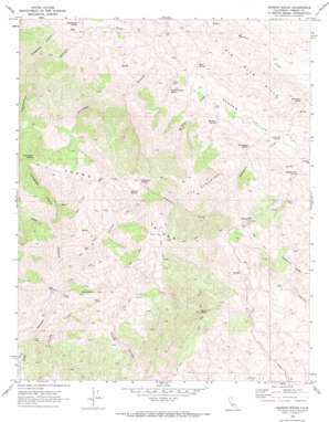
Joaquin Rocks Topo Map California
To zoom in, hover over the map of Joaquin Rocks
USGS Topo Quad 36120c4 - 1:24,000 scale
| Topo Map Name: | Joaquin Rocks |
| USGS Topo Quad ID: | 36120c4 |
| Print Size: | ca. 21 1/4" wide x 27" high |
| Southeast Coordinates: | 36.25° N latitude / 120.375° W longitude |
| Map Center Coordinates: | 36.3125° N latitude / 120.4375° W longitude |
| U.S. State: | CA |
| Filename: | o36120c4.jpg |
| Download Map JPG Image: | Joaquin Rocks topo map 1:24,000 scale |
| Map Type: | Topographic |
| Topo Series: | 7.5´ |
| Map Scale: | 1:24,000 |
| Source of Map Images: | United States Geological Survey (USGS) |
| Alternate Map Versions: |
Joaquin Rocks CA 1969, updated 1973 Download PDF Buy paper map Joaquin Rocks CA 2012 Download PDF Buy paper map Joaquin Rocks CA 2015 Download PDF Buy paper map |
1:24,000 Topo Quads surrounding Joaquin Rocks
> Back to 36120a1 at 1:100,000 scale
> Back to 36120a1 at 1:250,000 scale
> Back to U.S. Topo Maps home
Joaquin Rocks topo map: Gazetteer
Joaquin Rocks: Flats
The Clearing elevation 945m 3100′Joaquin Rocks: Pillars
Joaquin Rocks elevation 1256m 4120′Joaquin Rocks: Ranges
Big Blue Hills elevation 565m 1853′Joaquin Rocks: Ridges
Anticline Ridge elevation 1106m 3628′Joaquin Rocks: Springs
Domengine Spring elevation 508m 1666′Double Trough Spring elevation 508m 1666′
Homestead Spring elevation 273m 895′
Joaquin Spring elevation 1100m 3608′
Little Oak Spring elevation 443m 1453′
Mare Spring elevation 426m 1397′
Martinez Spring elevation 587m 1925′
Rattlesnake Spring elevation 433m 1420′
Sulphur Flat Spring elevation 483m 1584′
Sulphur Spring elevation 280m 918′
Zalba Spring elevation 1054m 3458′
Joaquin Rocks: Summits
Black Mountain elevation 1106m 3628′Donut Rock elevation 910m 2985′
Joaquin Rocks: Valleys
Horsethief Canyon elevation 463m 1519′Ne Hi Canyon elevation 675m 2214′
Nehi Canyon elevation 694m 2276′
Portuguese Canyon elevation 767m 2516′
Twentyfive Canyon elevation 358m 1174′
Urruttia Canyon elevation 326m 1069′
Joaquin Rocks digital topo map on disk
Buy this Joaquin Rocks topo map showing relief, roads, GPS coordinates and other geographical features, as a high-resolution digital map file on DVD:


