Five Points Topo Map California
To zoom in, hover over the map of Five Points
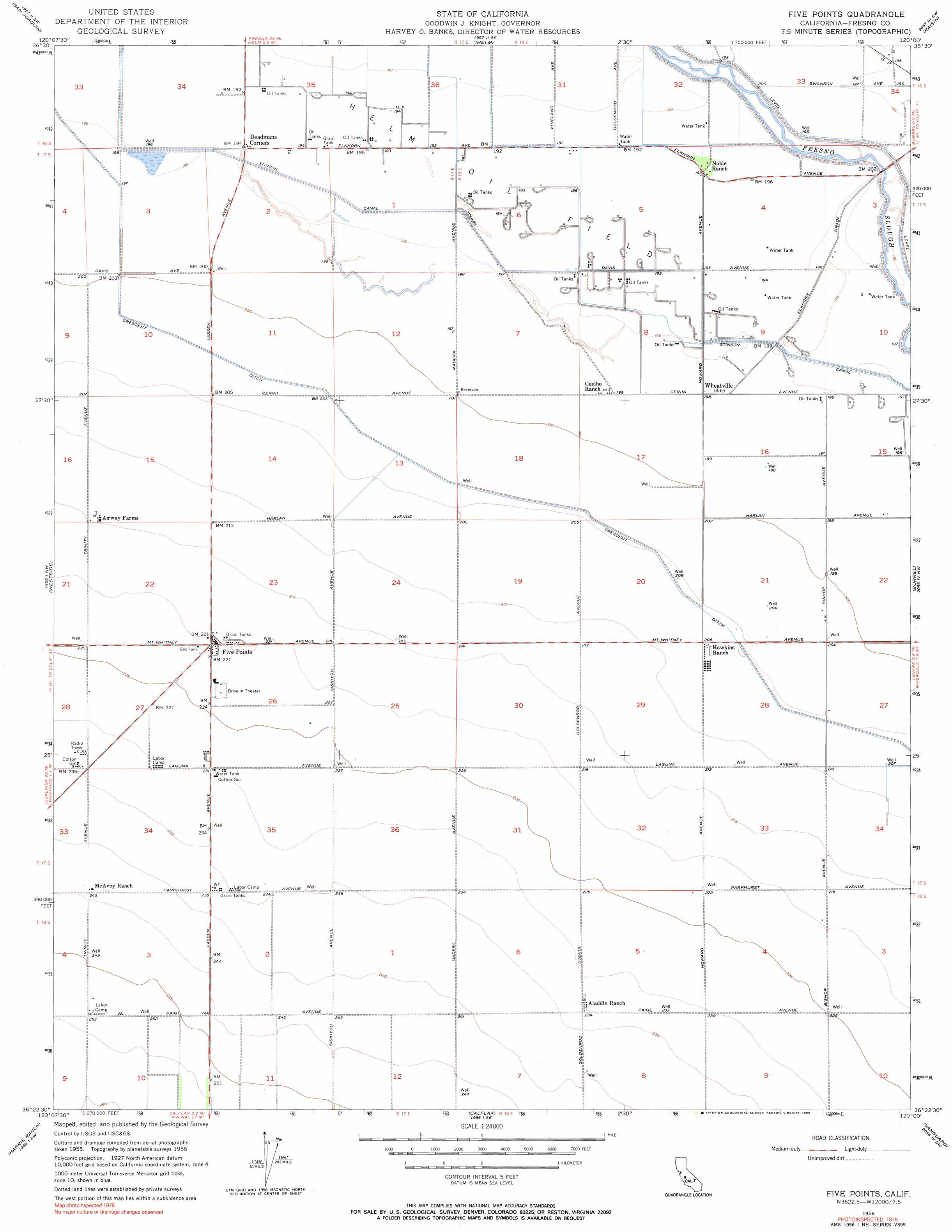
USGS Topo Quad 36120d1 - 1:24,000 scale
| Topo Map Name: | Five Points |
| USGS Topo Quad ID: | 36120d1 |
| Print Size: | ca. 21 1/4" wide x 27" high |
| Southeast Coordinates: | 36.375° N latitude / 120° W longitude |
| Map Center Coordinates: | 36.4375° N latitude / 120.0625° W longitude |
| U.S. State: | CA |
| Filename: | o36120d1.jpg |
| Download Map JPG Image: | Five Points topo map 1:24,000 scale |
| Map Type: | Topographic |
| Topo Series: | 7.5´ |
| Map Scale: | 1:24,000 |
| Source of Map Images: | United States Geological Survey (USGS) |
| Alternate Map Versions: |
Wheatville CA 1931, updated 1950 Download PDF Buy paper map Five Points CA 1956, updated 1957 Download PDF Buy paper map Five Points CA 1956, updated 1967 Download PDF Buy paper map Five Points CA 1956, updated 1990 Download PDF Buy paper map Five Points CA 2012 Download PDF Buy paper map Five Points CA 2015 Download PDF Buy paper map |
1:24,000 Topo Quads surrounding Five Points
Tranquillity |
Jamesan |
Kerman |
Kearney Park |
Fresno South |
Cantua Creek |
San Joaquin |
Helm |
Raisin |
Caruthers |
Tres Picos Farms |
Westside |
Five Points |
Burrel |
Riverdale |
Domengine Ranch |
Harris Ranch |
Calflax |
Vanguard |
Lemoore |
Coalinga |
Guijarral Hills |
Huron |
Westhaven |
Stratford |
> Back to 36120a1 at 1:100,000 scale
> Back to 36120a1 at 1:250,000 scale
> Back to U.S. Topo Maps home
Five Points topo map: Gazetteer
Five Points: Canals
Crescent Ditch elevation 63m 206′Stinson Canal elevation 60m 196′
Five Points: Oilfields
Helm Oil Field elevation 60m 196′Five Points: Populated Places
Five Points elevation 68m 223′Five Points digital topo map on disk
Buy this Five Points topo map showing relief, roads, GPS coordinates and other geographical features, as a high-resolution digital map file on DVD: