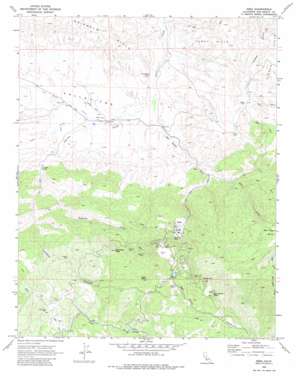
Idria Topo Map California
To zoom in, hover over the map of Idria
USGS Topo Quad 36120d6 - 1:24,000 scale
| Topo Map Name: | Idria |
| USGS Topo Quad ID: | 36120d6 |
| Print Size: | ca. 21 1/4" wide x 27" high |
| Southeast Coordinates: | 36.375° N latitude / 120.625° W longitude |
| Map Center Coordinates: | 36.4375° N latitude / 120.6875° W longitude |
| U.S. State: | CA |
| Filename: | o36120d6.jpg |
| Download Map JPG Image: | Idria topo map 1:24,000 scale |
| Map Type: | Topographic |
| Topo Series: | 7.5´ |
| Map Scale: | 1:24,000 |
| Source of Map Images: | United States Geological Survey (USGS) |
| Alternate Map Versions: |
Idria CA 1969, updated 1973 Download PDF Buy paper map Idria CA 1969, updated 1980 Download PDF Buy paper map Idria CA 2012 Download PDF Buy paper map Idria CA 2015 Download PDF Buy paper map |
1:24,000 Topo Quads surrounding Idria
> Back to 36120a1 at 1:100,000 scale
> Back to 36120a1 at 1:250,000 scale
> Back to U.S. Topo Maps home
Idria topo map: Gazetteer
Idria: Dams
New Idria 657 Dam elevation 1152m 3779′Idria: Mines
Aurora Mine elevation 1169m 3835′Camp Two Pit elevation 1125m 3690′
Clear Creek Mine elevation 1109m 3638′
Molina Mine elevation 1259m 4130′
New Idria Mine elevation 840m 2755′
Sampson Mine elevation 1075m 3526′
San Carlos Mines elevation 1423m 4668′
Spanish Mine elevation 1291m 4235′
Wonder Mine elevation 1213m 3979′
Idria: Populated Places
Idria elevation 807m 2647′Idria: Springs
Elkhorn Spring elevation 538m 1765′Larious Spring elevation 572m 1876′
Idria: Streams
East Fork San Carlos Creek elevation 556m 1824′Larious Creek elevation 448m 1469′
Lopez Creek elevation 500m 1640′
Los Pinos Creek elevation 493m 1617′
Sampson Creek elevation 616m 2020′
San Carlos Creek elevation 448m 1469′
Idria: Summits
Idria Peak elevation 1415m 4642′North Hill elevation 1418m 4652′
Sampson Peak elevation 1420m 4658′
San Carlos Peak elevation 1472m 4829′
Idria: Valleys
Larious Canyon elevation 576m 1889′Vallecitos elevation 489m 1604′
Idria: Wells
New Redford Oil Well elevation 471m 1545′Idria digital topo map on disk
Buy this Idria topo map showing relief, roads, GPS coordinates and other geographical features, as a high-resolution digital map file on DVD:


