Ortigalita Peak Topo Map California
To zoom in, hover over the map of Ortigalita Peak
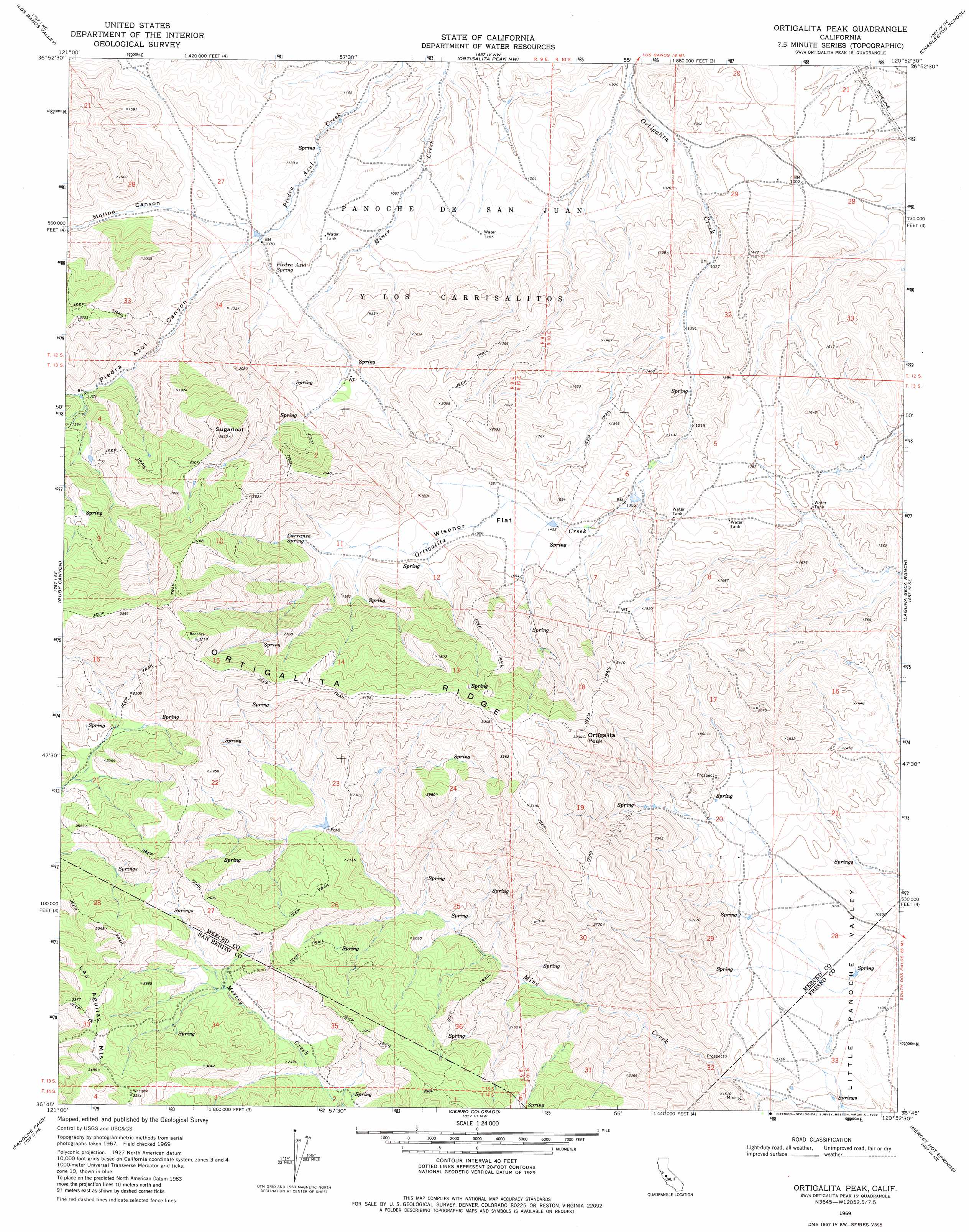
USGS Topo Quad 36120g8 - 1:24,000 scale
| Topo Map Name: | Ortigalita Peak |
| USGS Topo Quad ID: | 36120g8 |
| Print Size: | ca. 21 1/4" wide x 27" high |
| Southeast Coordinates: | 36.75° N latitude / 120.875° W longitude |
| Map Center Coordinates: | 36.8125° N latitude / 120.9375° W longitude |
| U.S. State: | CA |
| Filename: | o36120g8.jpg |
| Download Map JPG Image: | Ortigalita Peak topo map 1:24,000 scale |
| Map Type: | Topographic |
| Topo Series: | 7.5´ |
| Map Scale: | 1:24,000 |
| Source of Map Images: | United States Geological Survey (USGS) |
| Alternate Map Versions: |
Ortigalita Peak CA 1969, updated 1972 Download PDF Buy paper map Ortigalita Peak CA 1969, updated 1982 Download PDF Buy paper map Ortigalita Peak CA 2000, updated 2002 Download PDF Buy paper map Ortigalita Peak CA 2012 Download PDF Buy paper map Ortigalita Peak CA 2015 Download PDF Buy paper map |
1:24,000 Topo Quads surrounding Ortigalita Peak
Pacheco Pass |
San Luis Dam |
Volta |
Los Banos |
Delta Ranch |
Mariposa Peak |
Los Banos Valley |
Ortigalita Peak Nw |
Charleston School |
Dos Palos |
Quien Sabe Valley |
Ruby Canyon |
Ortigalita Peak |
Laguna Seca Ranch |
Hammonds Ranch |
Cherry Peak |
Panoche Pass |
Cerro Colorado |
Mercey Hot Springs |
Chounet Ranch |
Bickmore Canyon |
San Benito |
Llanada |
Panoche |
Tumey Hills |
> Back to 36120e1 at 1:100,000 scale
> Back to 36120a1 at 1:250,000 scale
> Back to U.S. Topo Maps home
Ortigalita Peak topo map: Gazetteer
Ortigalita Peak: Flats
Wisenor Flat elevation 461m 1512′Ortigalita Peak: Springs
Carranza Spring elevation 577m 1893′Piedra Azul Spring elevation 369m 1210′
Ortigalita Peak: Summits
Ortigalita Peak elevation 993m 3257′Sugarloaf elevation 857m 2811′
Ortigalita Peak: Valleys
Molina Canyon elevation 344m 1128′Piedra Azul Canyon elevation 339m 1112′
Ortigalita Peak digital topo map on disk
Buy this Ortigalita Peak topo map showing relief, roads, GPS coordinates and other geographical features, as a high-resolution digital map file on DVD: