Bonita Ranch Topo Map California
To zoom in, hover over the map of Bonita Ranch
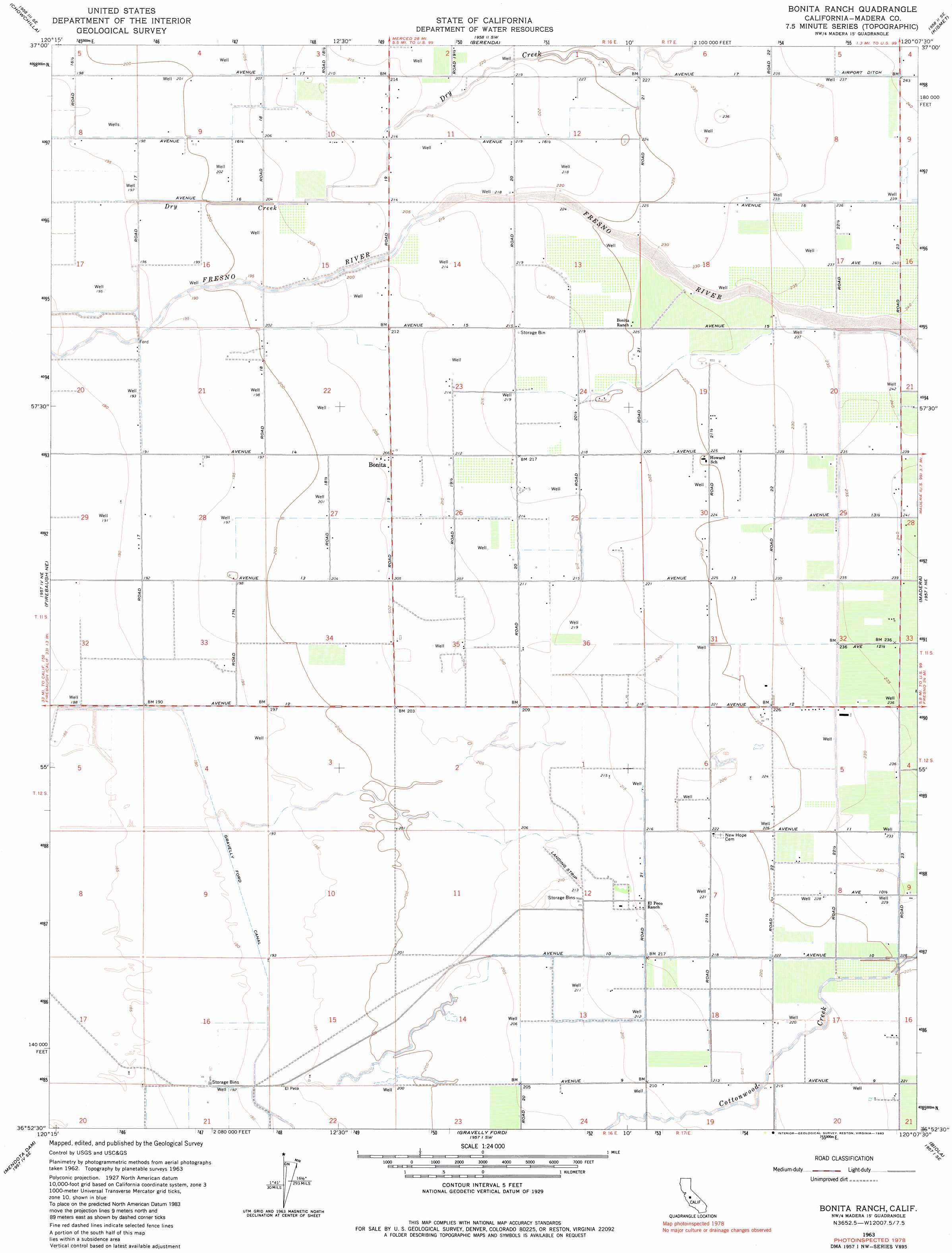
USGS Topo Quad 36120h2 - 1:24,000 scale
| Topo Map Name: | Bonita Ranch |
| USGS Topo Quad ID: | 36120h2 |
| Print Size: | ca. 21 1/4" wide x 27" high |
| Southeast Coordinates: | 36.875° N latitude / 120.125° W longitude |
| Map Center Coordinates: | 36.9375° N latitude / 120.1875° W longitude |
| U.S. State: | CA |
| Filename: | o36120h2.jpg |
| Download Map JPG Image: | Bonita Ranch topo map 1:24,000 scale |
| Map Type: | Topographic |
| Topo Series: | 7.5´ |
| Map Scale: | 1:24,000 |
| Source of Map Images: | United States Geological Survey (USGS) |
| Alternate Map Versions: |
Bonita Ranch CA 1946, updated 1960 Download PDF Buy paper map Bonita Ranch CA 1947 Download PDF Buy paper map Bonita Ranch CA 1963, updated 1964 Download PDF Buy paper map Bonita Ranch CA 1963, updated 1964 Download PDF Buy paper map Bonita Ranch CA 1963, updated 1983 Download PDF Buy paper map Bonita Ranch CA 1963, updated 1983 Download PDF Buy paper map Bonita Ranch CA 2012 Download PDF Buy paper map Bonita Ranch CA 2015 Download PDF Buy paper map |
1:24,000 Topo Quads surrounding Bonita Ranch
El Nido |
Plainsburg |
Le Grand |
Raynor Creek |
Raymond |
Bliss Ranch |
Chowchilla |
Berenda |
Kismet |
Daulton |
Poso Farm |
Firebaugh Ne |
Bonita Ranch |
Madera |
Gregg |
Firebaugh |
Mendota Dam |
Gravelly Ford |
Biola |
Herndon |
Coit Ranch |
Tranquillity |
Jamesan |
Kerman |
Kearney Park |
> Back to 36120e1 at 1:100,000 scale
> Back to 36120a1 at 1:250,000 scale
> Back to U.S. Topo Maps home
Bonita Ranch topo map: Gazetteer
Bonita Ranch: Airports
El Peco Ranch Airport elevation 65m 213′Haws Airport elevation 58m 190′
Bonita Ranch: Canals
Airport Ditch elevation 73m 239′Gravelly Ford Canal elevation 59m 193′
Bonita Ranch: Populated Places
Bonita elevation 63m 206′Bonita Ranch digital topo map on disk
Buy this Bonita Ranch topo map showing relief, roads, GPS coordinates and other geographical features, as a high-resolution digital map file on DVD: