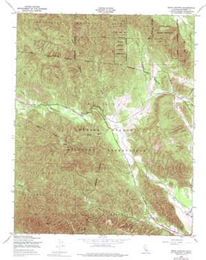
Bear Canyon Topo Map California
To zoom in, hover over the map of Bear Canyon
USGS Topo Quad 36121a3 - 1:24,000 scale
| Topo Map Name: | Bear Canyon |
| USGS Topo Quad ID: | 36121a3 |
| Print Size: | ca. 21 1/4" wide x 27" high |
| Southeast Coordinates: | 36° N latitude / 121.25° W longitude |
| Map Center Coordinates: | 36.0625° N latitude / 121.3125° W longitude |
| U.S. State: | CA |
| Filename: | o36121a3.jpg |
| Download Map JPG Image: | Bear Canyon topo map 1:24,000 scale |
| Map Type: | Topographic |
| Topo Series: | 7.5´ |
| Map Scale: | 1:24,000 |
| Source of Map Images: | United States Geological Survey (USGS) |
| Alternate Map Versions: |
Bear Canyon CA 1949, updated 1955 Download PDF Buy paper map Bear Canyon CA 1949, updated 1955 Download PDF Buy paper map Bear Canyon CA 1949, updated 1975 Download PDF Buy paper map Bear Canyon CA 1949, updated 1975 Download PDF Buy paper map Bear Canyon CA 1995, updated 2001 Download PDF Buy paper map Bear Canyon CA 2012 Download PDF Buy paper map Bear Canyon CA 2015 Download PDF Buy paper map |
| FStopo: | US Forest Service topo Bear Canyon is available: Download FStopo PDF Download FStopo TIF |
1:24,000 Topo Quads surrounding Bear Canyon
> Back to 36121a1 at 1:100,000 scale
> Back to 36120a1 at 1:250,000 scale
> Back to U.S. Topo Maps home
Bear Canyon topo map: Gazetteer
Bear Canyon: Dams
Coleman Reservoir Dam elevation 426m 1397′Milpitas Reservoir Dam elevation 368m 1207′
Bear Canyon: Reservoirs
Coleman Reservoir elevation 428m 1404′Milpitas Reservoir elevation 368m 1207′
Bear Canyon: Ridges
Rudolph Ridge elevation 845m 2772′Bear Canyon: Streams
Forest Creek elevation 364m 1194′Mission Creek elevation 312m 1023′
Bear Canyon: Valleys
Bear Canyon elevation 366m 1200′China Gulch elevation 363m 1190′
Coleman Canyon elevation 396m 1299′
Bear Canyon digital topo map on disk
Buy this Bear Canyon topo map showing relief, roads, GPS coordinates and other geographical features, as a high-resolution digital map file on DVD:


