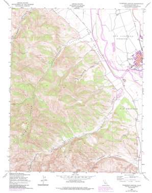
Thompson Canyon Topo Map California
To zoom in, hover over the map of Thompson Canyon
USGS Topo Quad 36121b2 - 1:24,000 scale
| Topo Map Name: | Thompson Canyon |
| USGS Topo Quad ID: | 36121b2 |
| Print Size: | ca. 21 1/4" wide x 27" high |
| Southeast Coordinates: | 36.125° N latitude / 121.125° W longitude |
| Map Center Coordinates: | 36.1875° N latitude / 121.1875° W longitude |
| U.S. State: | CA |
| Filename: | o36121b2.jpg |
| Download Map JPG Image: | Thompson Canyon topo map 1:24,000 scale |
| Map Type: | Topographic |
| Topo Series: | 7.5´ |
| Map Scale: | 1:24,000 |
| Source of Map Images: | United States Geological Survey (USGS) |
| Alternate Map Versions: |
Thompson Canyon CA 1949, updated 1952 Download PDF Buy paper map Thompson Canyon CA 1949, updated 1978 Download PDF Buy paper map Thompson Canyon CA 1949, updated 1984 Download PDF Buy paper map Thompson Canyon CA 2012 Download PDF Buy paper map Thompson Canyon CA 2015 Download PDF Buy paper map |
1:24,000 Topo Quads surrounding Thompson Canyon
> Back to 36121a1 at 1:100,000 scale
> Back to 36120a1 at 1:250,000 scale
> Back to U.S. Topo Maps home
Thompson Canyon topo map: Gazetteer
Thompson Canyon: Airports
Mee Memorial Hospital Heliport elevation 98m 321′Thompson Canyon: Parks
Forden Park elevation 95m 311′Salinas Valley Fairgrounds elevation 99m 324′
San Lorenzo County Park elevation 87m 285′
War Memorial Stadium elevation 96m 314′
Thompson Canyon: Populated Places
King City elevation 102m 334′Pine Canyon Mobile Estates elevation 117m 383′
Rio Plaza Mobile Home Park elevation 94m 308′
Thompson Canyon: Post Offices
King City Post Office elevation 102m 334′Thompson Canyon: Streams
San Lorenzo Creek elevation 86m 282′Thompson Canyon: Valleys
Branstetter Canyon elevation 97m 318′Cherry Canyon elevation 151m 495′
Pine Canyon elevation 93m 305′
Quinado Canyon elevation 98m 321′
Thompson Canyon elevation 84m 275′
Thompson Canyon digital topo map on disk
Buy this Thompson Canyon topo map showing relief, roads, GPS coordinates and other geographical features, as a high-resolution digital map file on DVD:


