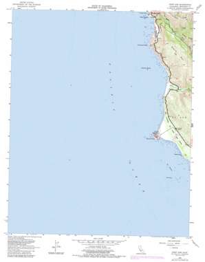
Point Sur Topo Map California
To zoom in, hover over the map of Point Sur
USGS Topo Quad 36121c8 - 1:24,000 scale
| Topo Map Name: | Point Sur |
| USGS Topo Quad ID: | 36121c8 |
| Print Size: | ca. 21 1/4" wide x 27" high |
| Southeast Coordinates: | 36.25° N latitude / 121.875° W longitude |
| Map Center Coordinates: | 36.3125° N latitude / 121.9375° W longitude |
| U.S. State: | CA |
| Filename: | o36121c8.jpg |
| Download Map JPG Image: | Point Sur topo map 1:24,000 scale |
| Map Type: | Topographic |
| Topo Series: | 7.5´ |
| Map Scale: | 1:24,000 |
| Source of Map Images: | United States Geological Survey (USGS) |
| Alternate Map Versions: |
Point Sur CA 1956, updated 1957 Download PDF Buy paper map Point Sur CA 1956, updated 1965 Download PDF Buy paper map Point Sur CA 1956, updated 1973 Download PDF Buy paper map Point Sur CA 1956, updated 1984 Download PDF Buy paper map Point Sur CA 1956, updated 1986 Download PDF Buy paper map Point Sur CA 2012 Download PDF Buy paper map Point Sur CA 2015 Download PDF Buy paper map |
| FStopo: | US Forest Service topo Point Sur is available: Download FStopo PDF Download FStopo TIF |
1:24,000 Topo Quads surrounding Point Sur
Monterey |
Seaside |
Spreckels |
||
Soberanes Point |
Mount Carmel |
Carmel Valley |
||
Point Sur |
Big Sur |
Ventana Cones |
||
Pfeiffer Point |
Partington Ridge |
|||
> Back to 36121a1 at 1:100,000 scale
> Back to 36120a1 at 1:250,000 scale
> Back to U.S. Topo Maps home
Point Sur topo map: Gazetteer
Point Sur: Areas
Sur Breakers elevation 0m 0′Point Sur: Bars
Sur Rock elevation 0m 0′Point Sur: Bridges
Bixby Bridge elevation 10m 32′Point Sur: Capes
Hurricane Point elevation 63m 206′Point Sur elevation 90m 295′
Point Sur: Islands
Castle Rock elevation 1m 3′Ventura Rocks elevation 1m 3′
Point Sur: Parks
Point Sur Lighthouse Reservation elevation 67m 219′Point Sur State Historic Park elevation 41m 134′
Point Sur: Ridges
Sierra Hill elevation 441m 1446′Point Sur: Streams
Bixby Creek elevation 2m 6′Little Sur River elevation 5m 16′
Sierra Creek elevation 48m 157′
Point Sur: Summits
Division Knoll elevation 189m 620′False Sur elevation 63m 206′
Point Sur digital topo map on disk
Buy this Point Sur topo map showing relief, roads, GPS coordinates and other geographical features, as a high-resolution digital map file on DVD:


