Topo Valley Topo Map California
To zoom in, hover over the map of Topo Valley
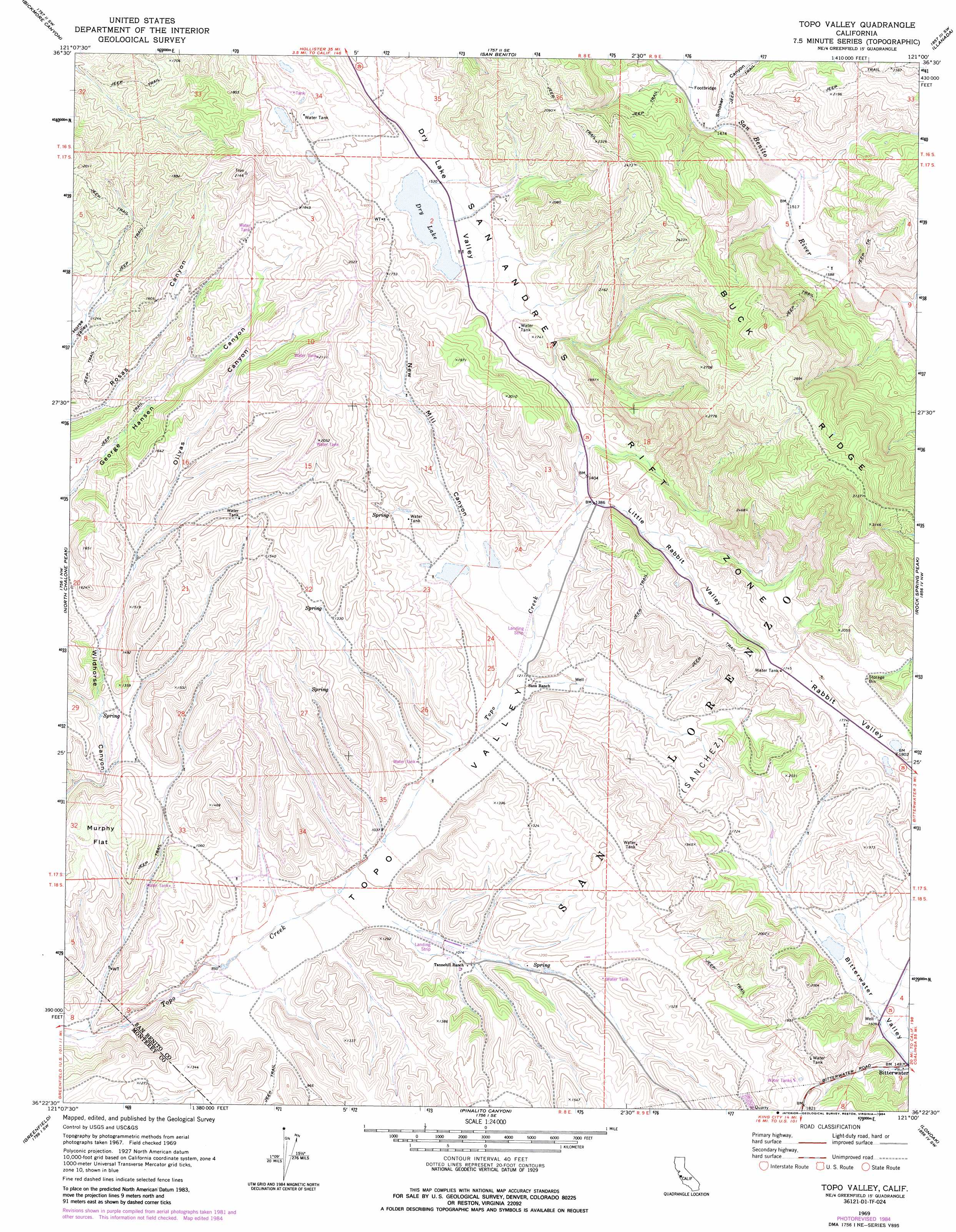
USGS Topo Quad 36121d1 - 1:24,000 scale
| Topo Map Name: | Topo Valley |
| USGS Topo Quad ID: | 36121d1 |
| Print Size: | ca. 21 1/4" wide x 27" high |
| Southeast Coordinates: | 36.375° N latitude / 121° W longitude |
| Map Center Coordinates: | 36.4375° N latitude / 121.0625° W longitude |
| U.S. State: | CA |
| Filename: | o36121d1.jpg |
| Download Map JPG Image: | Topo Valley topo map 1:24,000 scale |
| Map Type: | Topographic |
| Topo Series: | 7.5´ |
| Map Scale: | 1:24,000 |
| Source of Map Images: | United States Geological Survey (USGS) |
| Alternate Map Versions: |
Topo Valley CA 1969, updated 1973 Download PDF Buy paper map Topo Valley CA 1969, updated 1984 Download PDF Buy paper map Topo Valley CA 2012 Download PDF Buy paper map Topo Valley CA 2015 Download PDF Buy paper map |
1:24,000 Topo Quads surrounding Topo Valley
Paicines |
Cherry Peak |
Panoche Pass |
Cerro Colorado |
Mercey Hot Springs |
Mount Johnson |
Bickmore Canyon |
San Benito |
Llanada |
Panoche |
Soledad |
North Chalone Peak |
Topo Valley |
Rock Spring Peak |
Hernandez Reservoir |
Paraiso Springs |
Greenfield |
Pinalito Canyon |
Lonoak |
Hepsedam Peak |
Reliz Canyon |
Thompson Canyon |
San Lucas |
Nattrass Valley |
Monarch Peak |
> Back to 36121a1 at 1:100,000 scale
> Back to 36120a1 at 1:250,000 scale
> Back to U.S. Topo Maps home
Topo Valley topo map: Gazetteer
Topo Valley: Areas
San Andreas Rift Zone elevation 481m 1578′Topo Valley: Basins
Bitterwater Valley elevation 462m 1515′Dry Lake Valley elevation 466m 1528′
Rabbit Valley elevation 543m 1781′
Topo Valley: Flats
Murphy Flat elevation 397m 1302′Topo Valley: Lakes
Dry Lake elevation 462m 1515′Topo Valley: Populated Places
Bitterwater elevation 460m 1509′Topo Valley: Ridges
Buck Ridge elevation 876m 2874′Topo Valley: Valleys
Little Rabbit Valley elevation 424m 1391′New Mill Canyon elevation 386m 1266′
Olivas Canyon elevation 388m 1272′
Smoker Canyon elevation 460m 1509′
Topo Valley elevation 241m 790′
Topo Valley digital topo map on disk
Buy this Topo Valley topo map showing relief, roads, GPS coordinates and other geographical features, as a high-resolution digital map file on DVD: