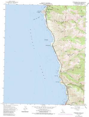
Soberanes Point Topo Map California
To zoom in, hover over the map of Soberanes Point
USGS Topo Quad 36121d8 - 1:24,000 scale
| Topo Map Name: | Soberanes Point |
| USGS Topo Quad ID: | 36121d8 |
| Print Size: | ca. 21 1/4" wide x 27" high |
| Southeast Coordinates: | 36.375° N latitude / 121.875° W longitude |
| Map Center Coordinates: | 36.4375° N latitude / 121.9375° W longitude |
| U.S. State: | CA |
| Filename: | o36121d8.jpg |
| Download Map JPG Image: | Soberanes Point topo map 1:24,000 scale |
| Map Type: | Topographic |
| Topo Series: | 7.5´ |
| Map Scale: | 1:24,000 |
| Source of Map Images: | United States Geological Survey (USGS) |
| Alternate Map Versions: |
Soberanes Point CA 1956, updated 1957 Download PDF Buy paper map Soberanes Point CA 1956, updated 1963 Download PDF Buy paper map Soberanes Point CA 1956, updated 1976 Download PDF Buy paper map Soberanes Point CA 1956, updated 1984 Download PDF Buy paper map Soberanes Point CA 1956, updated 1986 Download PDF Buy paper map Soberanes Point CA 1995, updated 2000 Download PDF Buy paper map Soberanes Point CA 2012 Download PDF Buy paper map Soberanes Point CA 2015 Download PDF Buy paper map |
1:24,000 Topo Quads surrounding Soberanes Point
Marina |
Salinas |
|||
Monterey |
Seaside |
Spreckels |
||
Soberanes Point |
Mount Carmel |
Carmel Valley |
||
Point Sur |
Big Sur |
Ventana Cones |
||
Pfeiffer Point |
Partington Ridge |
> Back to 36121a1 at 1:100,000 scale
> Back to 36120a1 at 1:250,000 scale
> Back to U.S. Topo Maps home
Soberanes Point topo map: Gazetteer
Soberanes Point: Bars
Yankee Point Breaker elevation 0m 0′Soberanes Point: Capes
Kasler Point elevation 6m 19′Rocky Point elevation 13m 42′
Soberanes Point elevation 14m 45′
Yankee Point elevation 15m 49′
Soberanes Point: Islands
Lobos Rock elevation 0m 0′Yankee Point Rock elevation 1m 3′
Soberanes Point: Parks
Garrapata State Park elevation 231m 757′Soberanes Point: Populated Places
Notleys Landing elevation 34m 111′Soberanes Point: Ridges
Portuguese Ridge elevation 588m 1929′Soberanes Point: Streams
Doud Creek elevation 3m 9′Garrapata Creek elevation 1m 3′
Joshua Creek elevation 35m 114′
Malpaso Creek elevation 8m 26′
Rocky Creek elevation 4m 13′
Soberanes Creek elevation 3m 9′
Wildcat Creek elevation 16m 52′
Soberanes Point: Summits
Cushing Mountain elevation 436m 1430′Puerta del Diablo elevation 554m 1817′
Whale Peak elevation 81m 265′
Soberanes Point: Trails
Rocky Ridge Trail elevation 426m 1397′Soberanes Canyon Trail elevation 427m 1400′
Soberanes Point: Valleys
Granite Canyon elevation 3m 9′Las Piedras Canyon elevation 4m 13′
Palo Colorado Canyon elevation 0m 0′
Wildcat Canyon elevation 130m 426′
Soberanes Point digital topo map on disk
Buy this Soberanes Point topo map showing relief, roads, GPS coordinates and other geographical features, as a high-resolution digital map file on DVD:


