Chualar Topo Map California
To zoom in, hover over the map of Chualar
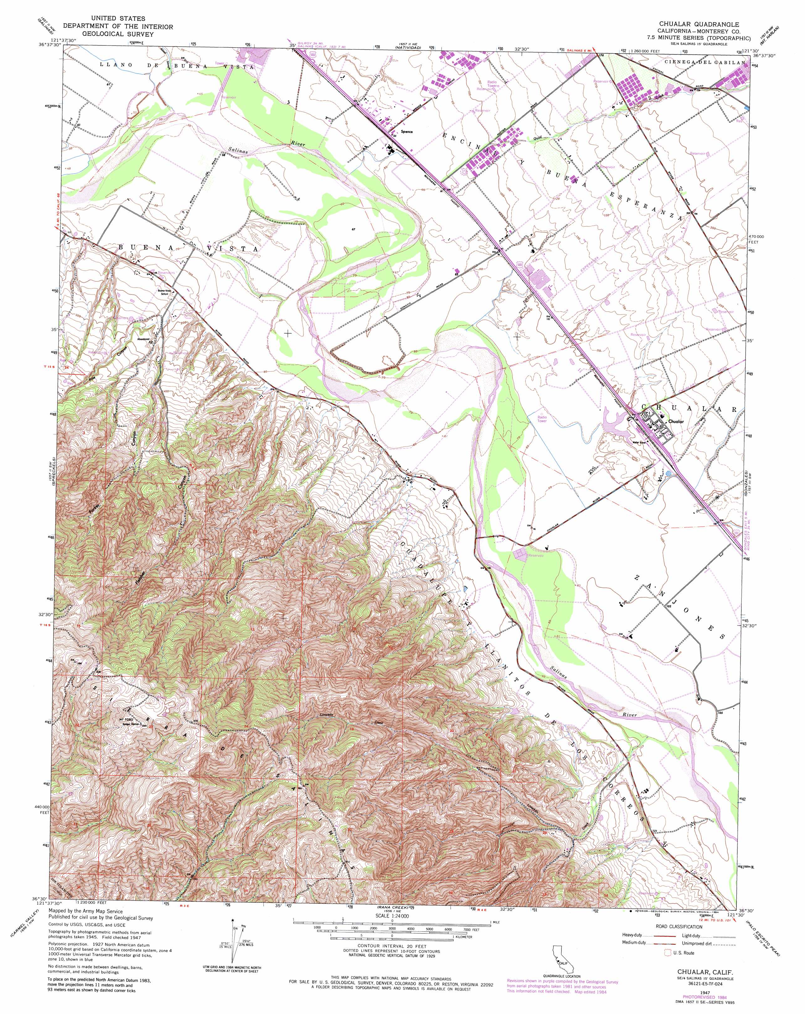
USGS Topo Quad 36121e5 - 1:24,000 scale
| Topo Map Name: | Chualar |
| USGS Topo Quad ID: | 36121e5 |
| Print Size: | ca. 21 1/4" wide x 27" high |
| Southeast Coordinates: | 36.5° N latitude / 121.5° W longitude |
| Map Center Coordinates: | 36.5625° N latitude / 121.5625° W longitude |
| U.S. State: | CA |
| Filename: | o36121e5.jpg |
| Download Map JPG Image: | Chualar topo map 1:24,000 scale |
| Map Type: | Topographic |
| Topo Series: | 7.5´ |
| Map Scale: | 1:24,000 |
| Source of Map Images: | United States Geological Survey (USGS) |
| Alternate Map Versions: |
Chualar CA 1947, updated 1948 Download PDF Buy paper map Chualar CA 1947, updated 1969 Download PDF Buy paper map Chualar CA 1947, updated 1969 Download PDF Buy paper map Chualar CA 1947, updated 1974 Download PDF Buy paper map Chualar CA 1947, updated 1984 Download PDF Buy paper map Chualar CA 2012 Download PDF Buy paper map Chualar CA 2015 Download PDF Buy paper map |
1:24,000 Topo Quads surrounding Chualar
Moss Landing |
Prunedale |
San Juan Bautista |
Hollister |
Tres Pinos |
Marina |
Salinas |
Natividad |
Mount Harlan |
Paicines |
Seaside |
Spreckels |
Chualar |
Gonzales |
Mount Johnson |
Mount Carmel |
Carmel Valley |
Rana Creek |
Palo Escrito Peak |
Soledad |
Big Sur |
Ventana Cones |
Chews Ridge |
Sycamore Flat |
Paraiso Springs |
> Back to 36121e1 at 1:100,000 scale
> Back to 36120a1 at 1:250,000 scale
> Back to U.S. Topo Maps home
Chualar topo map: Gazetteer
Chualar: Populated Places
Chualar elevation 35m 114′Spence elevation 25m 82′
Chualar: Streams
Chualar Creek elevation 23m 75′Limekiln Creek elevation 28m 91′
Quail Creek elevation 31m 101′
Chualar: Summits
Mount Toro elevation 1082m 3549′Chualar: Valleys
Fletcher Canyon elevation 92m 301′Parker Canyon elevation 99m 324′
Pine Canyon elevation 26m 85′
Chualar digital topo map on disk
Buy this Chualar topo map showing relief, roads, GPS coordinates and other geographical features, as a high-resolution digital map file on DVD: