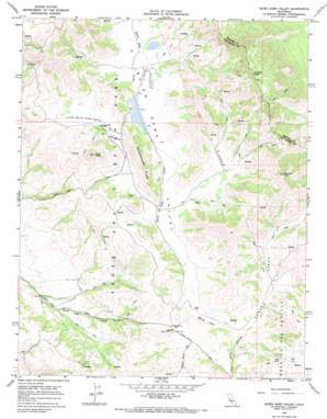
Quien Sabe Valley Topo Map California
To zoom in, hover over the map of Quien Sabe Valley
USGS Topo Quad 36121g2 - 1:24,000 scale
| Topo Map Name: | Quien Sabe Valley |
| USGS Topo Quad ID: | 36121g2 |
| Print Size: | ca. 21 1/4" wide x 27" high |
| Southeast Coordinates: | 36.75° N latitude / 121.125° W longitude |
| Map Center Coordinates: | 36.8125° N latitude / 121.1875° W longitude |
| U.S. State: | CA |
| Filename: | o36121g2.jpg |
| Download Map JPG Image: | Quien Sabe Valley topo map 1:24,000 scale |
| Map Type: | Topographic |
| Topo Series: | 7.5´ |
| Map Scale: | 1:24,000 |
| Source of Map Images: | United States Geological Survey (USGS) |
| Alternate Map Versions: |
Quien Sabe Valley CA 1968, updated 1971 Download PDF Buy paper map Quien Sabe Valley CA 2012 Download PDF Buy paper map Quien Sabe Valley CA 2015 Download PDF Buy paper map |
1:24,000 Topo Quads surrounding Quien Sabe Valley
> Back to 36121e1 at 1:100,000 scale
> Back to 36120a1 at 1:250,000 scale
> Back to U.S. Topo Maps home
Quien Sabe Valley topo map: Gazetteer
Quien Sabe Valley: Dams
J V De Laveaga 653 Dam elevation 513m 1683′Percolation Area 653-002 Dam elevation 491m 1610′
Quien Sabe Valley: Ridges
Schoolhouse Ridge elevation 672m 2204′Quien Sabe Valley: Summits
Cibo Peak elevation 846m 2775′Potrero Peak elevation 1132m 3713′
Reinoso Peak elevation 1049m 3441′
Quien Sabe Valley: Valleys
Cañada Verde elevation 472m 1548′Little Quien Sabe Valley elevation 486m 1594′
Quien Sabe Valley elevation 479m 1571′
Quien Sabe Valley digital topo map on disk
Buy this Quien Sabe Valley topo map showing relief, roads, GPS coordinates and other geographical features, as a high-resolution digital map file on DVD:


