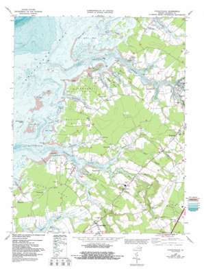
Pungoteague Topo Map Virginia
To zoom in, hover over the map of Pungoteague
USGS Topo Quad 37075f7 - 1:24,000 scale
| Topo Map Name: | Pungoteague |
| USGS Topo Quad ID: | 37075f7 |
| Print Size: | ca. 21 1/4" wide x 27" high |
| Southeast Coordinates: | 37.625° N latitude / 75.75° W longitude |
| Map Center Coordinates: | 37.6875° N latitude / 75.8125° W longitude |
| U.S. State: | VA |
| Filename: | o37075f7.jpg |
| Download Map JPG Image: | Pungoteague topo map 1:24,000 scale |
| Map Type: | Topographic |
| Topo Series: | 7.5´ |
| Map Scale: | 1:24,000 |
| Source of Map Images: | United States Geological Survey (USGS) |
| Alternate Map Versions: |
Pungoteague VA 1943, updated 1962 Download PDF Buy paper map Pungoteague VA 1968, updated 1972 Download PDF Buy paper map Pungoteague VA 1968, updated 1987 Download PDF Buy paper map Pungoteague VA 1968, updated 1992 Download PDF Buy paper map Pungoteague VA 2011 Download PDF Buy paper map Pungoteague VA 2013 Download PDF Buy paper map Pungoteague VA 2016 Download PDF Buy paper map |
1:24,000 Topo Quads surrounding Pungoteague
> Back to 37075e1 at 1:100,000 scale
> Back to 37074a1 at 1:250,000 scale
> Back to U.S. Topo Maps home
Pungoteague topo map: Gazetteer
Pungoteague: Airports
Accomack County Airport elevation 13m 42′Peace and Plenty Farm Airport elevation 1m 3′
Pungoteague: Bays
Kusian Cove elevation 0m 0′Poplar Cove elevation 1m 3′
Pungoteague: Beaches
Sound Beach elevation 0m 0′Pungoteague: Capes
Bailey Neck elevation 2m 6′Bailey Point elevation 0m 0′
Bluff Point elevation 1m 3′
Broadway Neck elevation 1m 3′
Coffin Point elevation 1m 3′
Finneys Neck elevation 1m 3′
Hacks Neck elevation 1m 3′
Indian Point elevation 0m 0′
Klondike Point elevation 1m 3′
Onley Point elevation 1m 3′
Sluitkill Neck elevation 1m 3′
Thicket Point elevation 0m 0′
Ware Point elevation 1m 3′
Warehouse Point elevation 0m 0′
West Point elevation 1m 3′
Yeo Neck elevation 2m 6′
Pungoteague: Dams
Tankard Dam elevation 5m 16′Pungoteague: Guts
Buckland Gut elevation -9m -30′Hancock Gut elevation 1m 3′
Pungoteague: Islands
Finneys Island elevation 0m 0′Parkers Island elevation 1m 3′
Scarborough Island elevation 1m 3′
Pungoteague: Populated Places
Bobtown elevation 6m 19′Cashville elevation 3m 9′
Coocheyville elevation 1m 3′
Crockett Town elevation 1m 3′
East Point elevation 1m 3′
Hacksneck elevation 1m 3′
Harborton elevation 1m 3′
Little Hell elevation 7m 22′
Locksville elevation 8m 26′
Mount Nebo elevation 3m 9′
Pine Ridge Mobile Home Park elevation 10m 32′
Pungoteague elevation 8m 26′
Savageville elevation 9m 29′
Smithville elevation 1m 3′
South Chesconessex elevation 1m 3′
Pungoteague: Post Offices
Harborton Post Office elevation 1m 3′Onancock Post Office elevation 5m 16′
Pungoteague Post Office elevation 7m 22′
Pungoteague: Reservoirs
Tankard Pond elevation 5m 16′Pungoteague: Streams
Back Creek elevation 0m 0′Bull Branch elevation 7m 22′
Cedar Creek elevation -2m -7′
Central Branch Onancock Creek elevation 0m 0′
Finneys Creek elevation 0m 0′
Hollies Church Branch elevation 0m 0′
Horse Hole Creek elevation 0m 0′
Leatherberry Creek elevation 0m 0′
Matchotank Creek elevation 0m 0′
Moore Branch elevation 0m 0′
North Branch Onancock Creek elevation 0m 0′
Onancock Creek elevation 0m 0′
Pakers Creek elevation 0m 0′
Pungoteague Creek elevation 0m 0′
South Branch Onancock Creek elevation 0m 0′
Tarkill Creek elevation 0m 0′
Taylor Creek elevation 0m 0′
Thicket Creek elevation 0m 0′
Titlow Creek elevation 1m 3′
Underhill Creek elevation 0m 0′
Warehouse Prong elevation 0m 0′
Pungoteague: Swamps
Chandler Marsh elevation 1m 3′Dahl Swamp elevation 3m 9′
Parkers Marsh elevation 1m 3′
Pungoteague digital topo map on disk
Buy this Pungoteague topo map showing relief, roads, GPS coordinates and other geographical features, as a high-resolution digital map file on DVD:
Atlantic Coast (NY, NJ, PA, DE, MD, VA, NC)
Buy digital topo maps: Atlantic Coast (NY, NJ, PA, DE, MD, VA, NC)


