Bethel Beach Topo Map Virginia
To zoom in, hover over the map of Bethel Beach
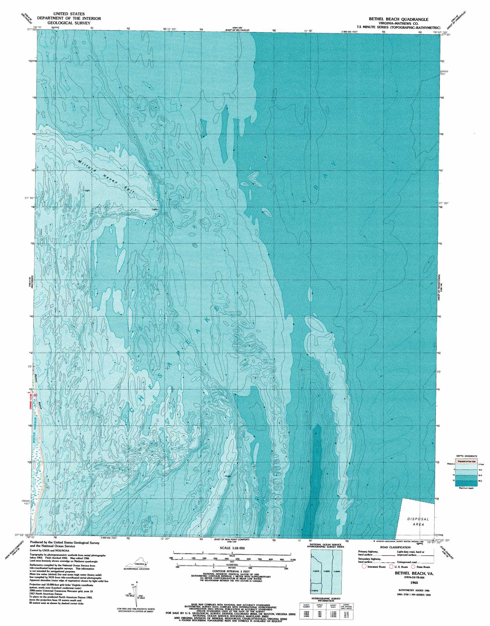
USGS Topo Quad 37076d2 - 1:24,000 scale
| Topo Map Name: | Bethel Beach |
| USGS Topo Quad ID: | 37076d2 |
| Print Size: | ca. 21 1/4" wide x 27" high |
| Southeast Coordinates: | 37.375° N latitude / 76.125° W longitude |
| Map Center Coordinates: | 37.4375° N latitude / 76.1875° W longitude |
| U.S. State: | VA |
| Filename: | o37076d2.jpg |
| Download Map JPG Image: | Bethel Beach topo map 1:24,000 scale |
| Map Type: | Topographic |
| Topo Series: | 7.5´ |
| Map Scale: | 1:24,000 |
| Source of Map Images: | United States Geological Survey (USGS) |
| Alternate Map Versions: |
Bethel Beach VA 1965, updated 1987 Download PDF Buy paper map Bethel Beach VA 2011 Download PDF Buy paper map Bethel Beach VA 2013 Download PDF Buy paper map Bethel Beach VA 2016 Download PDF Buy paper map |
1:24,000 Topo Quads surrounding Bethel Beach
Irvington |
Fleets Bay |
East of Fleets Bay |
West Of Nandua Creek |
Nandua Creek |
Wilton |
Deltaville |
East Of Deltaville |
West Of Jamesville |
Jamesville |
Ware Neck |
Mathews |
Bethel Beach |
West Of Franktown |
Franktown |
Achilles |
New Point Comfort |
East Of New Point Comfort |
Cape Charles |
Cheriton |
Poquoson West |
Poquoson East |
East Of Poquoson East |
Elliotts Creek |
Townsend |
> Back to 37076a1 at 1:100,000 scale
> Back to 37076a1 at 1:250,000 scale
> Back to U.S. Topo Maps home
Bethel Beach topo map: Gazetteer
Bethel Beach: Bars
Wolf Trap elevation 0m 0′Bethel Beach: Beaches
Bethel Beach elevation 0m 0′Bethel Beach digital topo map on disk
Buy this Bethel Beach topo map showing relief, roads, GPS coordinates and other geographical features, as a high-resolution digital map file on DVD:
Atlantic Coast (NY, NJ, PA, DE, MD, VA, NC)
Buy digital topo maps: Atlantic Coast (NY, NJ, PA, DE, MD, VA, NC)
 map DVD")