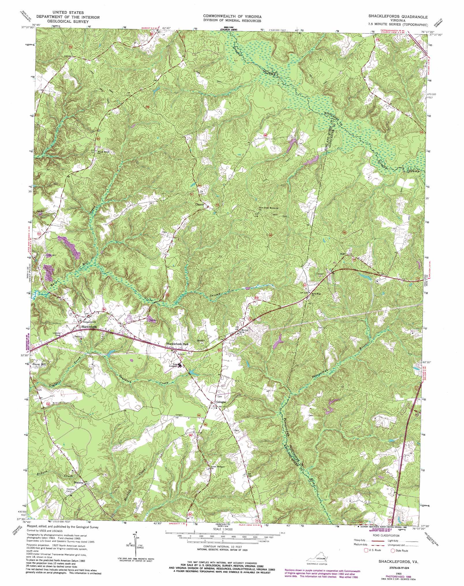
Shacklefords Topo Map Virginia
To zoom in, hover over the map of Shacklefords
USGS Topo Quad 37076e6 - 1:24,000 scale
| Topo Map Name: | Shacklefords |
| USGS Topo Quad ID: | 37076e6 |
| Print Size: | ca. 21 1/4" wide x 27" high |
| Southeast Coordinates: | 37.5° N latitude / 76.625° W longitude |
| Map Center Coordinates: | 37.5625° N latitude / 76.6875° W longitude |
| U.S. State: | VA |
| Filename: | o37076e6.jpg |
| Download Map JPG Image: | Shacklefords topo map 1:24,000 scale |
| Map Type: | Topographic |
| Topo Series: | 7.5´ |
| Map Scale: | 1:24,000 |
| Source of Map Images: | United States Geological Survey (USGS) |
| Alternate Map Versions: |
Shacklefords VA 1949 Download PDF Buy paper map Shacklefords VA 1949 Download PDF Buy paper map Shacklefords VA 1965, updated 1966 Download PDF Buy paper map Shacklefords VA 1965, updated 1974 Download PDF Buy paper map Shacklefords VA 1965, updated 1980 Download PDF Buy paper map Shacklefords VA 1965, updated 1986 Download PDF Buy paper map Shacklefords VA 2011 Download PDF Buy paper map Shacklefords VA 2013 Download PDF Buy paper map Shacklefords VA 2016 Download PDF Buy paper map |
1:24,000 Topo Quads surrounding Shacklefords
Millers Tavern |
Dunnsville |
Morattico |
Lively |
Lancaster |
King And Queen Court House |
Truhart |
Church View |
Urbanna |
Irvington |
New Kent |
West Point |
Shacklefords |
Saluda |
Wilton |
Walkers |
Toano |
Gressitt |
Gloucester |
Ware Neck |
Brandon |
Norge |
Williamsburg |
Clay Bank |
Achilles |
> Back to 37076e1 at 1:100,000 scale
> Back to 37076a1 at 1:250,000 scale
> Back to U.S. Topo Maps home
Shacklefords topo map: Gazetteer
Shacklefords: Populated Places
Batt elevation 38m 124′Beulahland elevation 34m 111′
Clancie elevation 41m 134′
Cologne elevation 32m 104′
Dutton (historical) elevation 37m 121′
Hockley elevation 21m 68′
Owl Trap elevation 31m 101′
Shacklefords elevation 23m 75′
Shacklefords Fork elevation 29m 95′
Snow Hill elevation 18m 59′
Shacklefords: Streams
Glebe Swamp elevation 16m 52′Shacklefords digital topo map on disk
Buy this Shacklefords topo map showing relief, roads, GPS coordinates and other geographical features, as a high-resolution digital map file on DVD:
Atlantic Coast (NY, NJ, PA, DE, MD, VA, NC)
Buy digital topo maps: Atlantic Coast (NY, NJ, PA, DE, MD, VA, NC)
 map DVD")