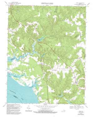
Lively Topo Map Virginia
To zoom in, hover over the map of Lively
USGS Topo Quad 37076g5 - 1:24,000 scale
| Topo Map Name: | Lively |
| USGS Topo Quad ID: | 37076g5 |
| Print Size: | ca. 21 1/4" wide x 27" high |
| Southeast Coordinates: | 37.75° N latitude / 76.5° W longitude |
| Map Center Coordinates: | 37.8125° N latitude / 76.5625° W longitude |
| U.S. State: | VA |
| Filename: | o37076g5.jpg |
| Download Map JPG Image: | Lively topo map 1:24,000 scale |
| Map Type: | Topographic |
| Topo Series: | 7.5´ |
| Map Scale: | 1:24,000 |
| Source of Map Images: | United States Geological Survey (USGS) |
| Alternate Map Versions: |
Litwalton VA 1948 Download PDF Buy paper map Litwalton VA 1948 Download PDF Buy paper map Lively VA 1968, updated 1971 Download PDF Buy paper map Lively VA 1968, updated 1983 Download PDF Buy paper map Lively VA 1968, updated 1983 Download PDF Buy paper map Lively VA 1968, updated 1993 Download PDF Buy paper map Lively VA 2011 Download PDF Buy paper map Lively VA 2013 Download PDF Buy paper map Lively VA 2016 Download PDF Buy paper map |
1:24,000 Topo Quads surrounding Lively
> Back to 37076e1 at 1:100,000 scale
> Back to 37076a1 at 1:250,000 scale
> Back to U.S. Topo Maps home
Lively topo map: Gazetteer
Lively: Capes
Colbert Point elevation 0m 0′Lively: Dams
Balls Millpond Dam elevation 1m 3′Blackmore Millpond Dam elevation 3m 9′
Chinns Dam elevation 5m 16′
Foxs Mill Dam elevation 3m 9′
Lanier-Davis Dam elevation 0m 0′
Marsh Dam elevation 36m 118′
Lively: Islands
Belle Isle elevation 3m 9′Lively: Populated Places
Alfonso elevation 35m 114′Boer elevation 4m 13′
Bridgetown (historical) elevation 28m 91′
Downings elevation 39m 127′
Fairplay elevation 38m 124′
Griffins Landing elevation 2m 6′
Lara elevation 42m 137′
Litwalton elevation 37m 121′
Lively elevation 34m 111′
Moon Corner elevation 43m 141′
Nuttsville elevation 42m 137′
Pierces Corner elevation 32m 104′
Robley elevation 35m 114′
Somers elevation 20m 65′
Lively: Post Offices
Nuttsville Post Office elevation 43m 141′Lively: Reservoirs
Balls Millpond elevation 1m 3′Blackmore Millpond elevation 5m 16′
Blakemore Millpond elevation 3m 9′
Chinns Millpond elevation 8m 26′
Chinns Pond elevation 5m 16′
Morattico Old Mill Pond elevation 5m 16′
Lively: Streams
Balls Branch elevation 2m 6′Deep Creek elevation 0m 0′
Mulberry Creek elevation 0m 0′
Wells His Creek elevation 6m 19′
Lively digital topo map on disk
Buy this Lively topo map showing relief, roads, GPS coordinates and other geographical features, as a high-resolution digital map file on DVD:
Atlantic Coast (NY, NJ, PA, DE, MD, VA, NC)
Buy digital topo maps: Atlantic Coast (NY, NJ, PA, DE, MD, VA, NC)


