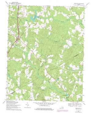
Templeton Topo Map Virginia
To zoom in, hover over the map of Templeton
USGS Topo Quad 37077a3 - 1:24,000 scale
| Topo Map Name: | Templeton |
| USGS Topo Quad ID: | 37077a3 |
| Print Size: | ca. 21 1/4" wide x 27" high |
| Southeast Coordinates: | 37° N latitude / 77.25° W longitude |
| Map Center Coordinates: | 37.0625° N latitude / 77.3125° W longitude |
| U.S. State: | VA |
| Filename: | o37077a3.jpg |
| Download Map JPG Image: | Templeton topo map 1:24,000 scale |
| Map Type: | Topographic |
| Topo Series: | 7.5´ |
| Map Scale: | 1:24,000 |
| Source of Map Images: | United States Geological Survey (USGS) |
| Alternate Map Versions: |
Lees Mill Pond VA 1952 Download PDF Buy paper map Lees Mill Pond VA 1952, updated 1959 Download PDF Buy paper map Templeton VA 1969, updated 1971 Download PDF Buy paper map Templeton VA 1969, updated 1975 Download PDF Buy paper map Templeton VA 2010 Download PDF Buy paper map Templeton VA 2013 Download PDF Buy paper map Templeton VA 2016 Download PDF Buy paper map |
1:24,000 Topo Quads surrounding Templeton
> Back to 37077a1 at 1:100,000 scale
> Back to 37076a1 at 1:250,000 scale
> Back to U.S. Topo Maps home
Templeton topo map: Gazetteer
Templeton: Crossings
Interchange 41 elevation 42m 137′Templeton: Dams
Belsches Dam elevation 17m 55′Johnson Dam elevation 29m 95′
Lees Dam elevation 37m 121′
Templeton: Populated Places
Bexley Trailer Park elevation 39m 127′Coddyshore (historical) elevation 37m 121′
Derby (historical) elevation 38m 124′
Lees Mill elevation 34m 111′
Reeves (historical) elevation 42m 137′
Talpa (historical) elevation 34m 111′
Templeton elevation 47m 154′
Templeton: Reservoirs
Bellches Millpond elevation 17m 55′Belsches Millpond elevation 17m 55′
Couches Pond elevation 26m 85′
Johnsons Pond elevation 29m 95′
Lees Millpond elevation 37m 121′
Templeton: Streams
Belsches Mill Swamp elevation 18m 59′Cherry Orchard Branch elevation 21m 68′
Indian Swamp elevation 22m 72′
Jones Hole Swamp elevation 19m 62′
Templeton digital topo map on disk
Buy this Templeton topo map showing relief, roads, GPS coordinates and other geographical features, as a high-resolution digital map file on DVD:
Atlantic Coast (NY, NJ, PA, DE, MD, VA, NC)
Buy digital topo maps: Atlantic Coast (NY, NJ, PA, DE, MD, VA, NC)


