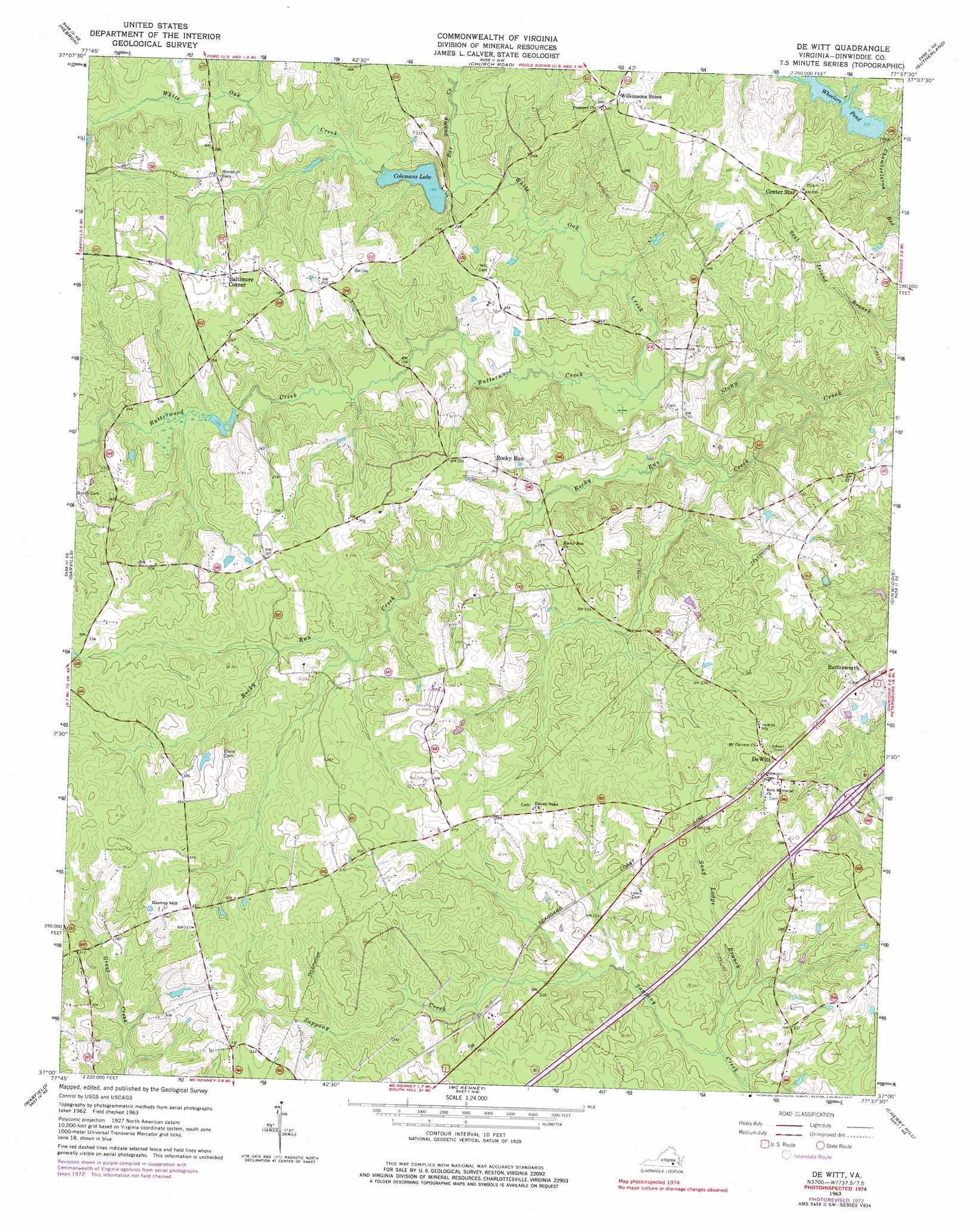
De Witt Topo Map Virginia
To zoom in, hover over the map of De Witt
USGS Topo Quad 37077a6 - 1:24,000 scale
| Topo Map Name: | De Witt |
| USGS Topo Quad ID: | 37077a6 |
| Print Size: | ca. 21 1/4" wide x 27" high |
| Southeast Coordinates: | 37° N latitude / 77.625° W longitude |
| Map Center Coordinates: | 37.0625° N latitude / 77.6875° W longitude |
| U.S. State: | VA |
| Filename: | o37077a6.jpg |
| Download Map JPG Image: | De Witt topo map 1:24,000 scale |
| Map Type: | Topographic |
| Topo Series: | 7.5´ |
| Map Scale: | 1:24,000 |
| Source of Map Images: | United States Geological Survey (USGS) |
| Alternate Map Versions: |
De Witt VA 1943, updated 1961 Download PDF Buy paper map De Witt VA 1963, updated 1965 Download PDF Buy paper map De Witt VA 1963, updated 1972 Download PDF Buy paper map De Witt VA 1963, updated 1977 Download PDF Buy paper map DeWitt VA 2010 Download PDF Buy paper map DeWitt VA 2013 Download PDF Buy paper map DeWitt VA 2016 Download PDF Buy paper map |
1:24,000 Topo Quads surrounding De Witt
Amelia Court House |
Mannboro |
Winterpock |
Beach |
Chester |
Wellville |
Hebron |
Church Road |
Sutherland |
Petersburg |
Blackstone East |
Darvills |
De Witt |
Dinwiddie |
Carson |
Danieltown |
Warfield |
Mckenney |
Cherry Hill |
Stony Creek |
Alberta |
Lawrenceville |
Smoky Ordinary |
Purdy |
Jarratt |
> Back to 37077a1 at 1:100,000 scale
> Back to 37076a1 at 1:250,000 scale
> Back to U.S. Topo Maps home
De Witt topo map: Gazetteer
De Witt: Crossings
Interchange 48 elevation 78m 255′De Witt: Dams
Coleman Dam elevation 61m 200′Wheelers Dam elevation 62m 203′
De Witt: Populated Places
Baltimore Corner elevation 93m 305′Borthwick (historical) elevation 88m 288′
Butterworth elevation 74m 242′
DeWitt elevation 90m 295′
Rocky Run elevation 74m 242′
De Witt: Reservoirs
Coleman Lake elevation 63m 206′Colemans Lake elevation 61m 200′
Wheelers Pond elevation 62m 203′
De Witt: Streams
Bar Swamp Creek elevation 59m 193′Butterwood Creek elevation 52m 170′
Rocky Run Creek elevation 52m 170′
Snap Lodge Branch elevation 55m 180′
White Oak Creek elevation 52m 170′
De Witt: Summits
Gunns Hill elevation 106m 347′De Witt digital topo map on disk
Buy this De Witt topo map showing relief, roads, GPS coordinates and other geographical features, as a high-resolution digital map file on DVD:
Atlantic Coast (NY, NJ, PA, DE, MD, VA, NC)
Buy digital topo maps: Atlantic Coast (NY, NJ, PA, DE, MD, VA, NC)
 map DVD")