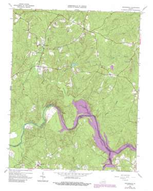
Winterpock Topo Map Virginia
To zoom in, hover over the map of Winterpock
USGS Topo Quad 37077c6 - 1:24,000 scale
| Topo Map Name: | Winterpock |
| USGS Topo Quad ID: | 37077c6 |
| Print Size: | ca. 21 1/4" wide x 27" high |
| Southeast Coordinates: | 37.25° N latitude / 77.625° W longitude |
| Map Center Coordinates: | 37.3125° N latitude / 77.6875° W longitude |
| U.S. State: | VA |
| Filename: | o37077c6.jpg |
| Download Map JPG Image: | Winterpock topo map 1:24,000 scale |
| Map Type: | Topographic |
| Topo Series: | 7.5´ |
| Map Scale: | 1:24,000 |
| Source of Map Images: | United States Geological Survey (USGS) |
| Alternate Map Versions: |
Winterpock VA 1943, updated 1961 Download PDF Buy paper map Winterpock VA 1963, updated 1965 Download PDF Buy paper map Winterpock VA 1963, updated 1969 Download PDF Buy paper map Winterpock VA 1963, updated 1978 Download PDF Buy paper map Winterpock VA 1963, updated 1987 Download PDF Buy paper map Winterpock VA 1979, updated 1982 Download PDF Buy paper map Winterpock VA 2010 Download PDF Buy paper map Winterpock VA 2013 Download PDF Buy paper map Winterpock VA 2016 Download PDF Buy paper map |
1:24,000 Topo Quads surrounding Winterpock
> Back to 37077a1 at 1:100,000 scale
> Back to 37076a1 at 1:250,000 scale
> Back to U.S. Topo Maps home
Winterpock topo map: Gazetteer
Winterpock: Bridges
Eppes Bridge (historical) elevation 48m 157′Winterpock: Dams
Kcratchs Dam elevation 89m 291′Vest Dam elevation 62m 203′
Winterpock: Islands
Goose Island elevation 47m 154′Winterpock: Populated Places
Coalboro (historical) elevation 89m 291′Eppes Falls (historical) elevation 60m 196′
Holly (historical) elevation 95m 311′
Matoaca (historical) elevation 71m 232′
Perdue (historical) elevation 88m 288′
Summit elevation 102m 334′
Winterpock elevation 62m 203′
Winterpock: Reservoirs
Kcratchs Pond elevation 89m 291′Winterpock: Streams
Namozine Creek elevation 48m 157′Nooning Creek elevation 48m 157′
Surline Branch elevation 51m 167′
Winterpock Creek elevation 48m 157′
Winticomack Creek elevation 49m 160′
Winterpock digital topo map on disk
Buy this Winterpock topo map showing relief, roads, GPS coordinates and other geographical features, as a high-resolution digital map file on DVD:
Atlantic Coast (NY, NJ, PA, DE, MD, VA, NC)
Buy digital topo maps: Atlantic Coast (NY, NJ, PA, DE, MD, VA, NC)


