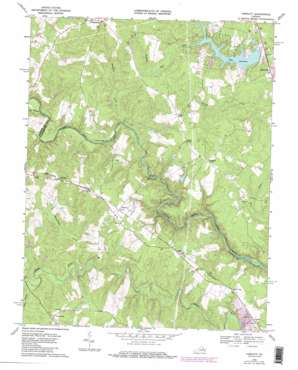
Hewlett Topo Map Virginia
To zoom in, hover over the map of Hewlett
USGS Topo Quad 37077h5 - 1:24,000 scale
| Topo Map Name: | Hewlett |
| USGS Topo Quad ID: | 37077h5 |
| Print Size: | ca. 21 1/4" wide x 27" high |
| Southeast Coordinates: | 37.875° N latitude / 77.5° W longitude |
| Map Center Coordinates: | 37.9375° N latitude / 77.5625° W longitude |
| U.S. State: | VA |
| Filename: | o37077h5.jpg |
| Download Map JPG Image: | Hewlett topo map 1:24,000 scale |
| Map Type: | Topographic |
| Topo Series: | 7.5´ |
| Map Scale: | 1:24,000 |
| Source of Map Images: | United States Geological Survey (USGS) |
| Alternate Map Versions: |
Hewlett VA 1943, updated 1961 Download PDF Buy paper map Hewlett VA 1969, updated 1971 Download PDF Buy paper map Hewlett VA 1969, updated 1977 Download PDF Buy paper map Hewlett VA 1969, updated 1985 Download PDF Buy paper map Hewlett VA 1969, updated 1985 Download PDF Buy paper map Hewlett VA 2010 Download PDF Buy paper map Hewlett VA 2013 Download PDF Buy paper map Hewlett VA 2016 Download PDF Buy paper map |
1:24,000 Topo Quads surrounding Hewlett
> Back to 37077e1 at 1:100,000 scale
> Back to 37076a1 at 1:250,000 scale
> Back to U.S. Topo Maps home
Hewlett topo map: Gazetteer
Hewlett: Bridges
Butlers Bridge elevation 42m 137′Landora Bridge elevation 45m 147′
Hewlett: Dams
Lake Caroline Dam elevation 60m 196′USRY Properties Incorporated Dam elevation 65m 213′
Hewlett: Mines
Doswell Quarry elevation 67m 219′Hewlett: Populated Places
Cedar Fork elevation 84m 275′Chilesburg elevation 98m 321′
Coatesville elevation 88m 288′
Coffey Corner elevation 79m 259′
Golansville elevation 70m 229′
Hewlett elevation 86m 282′
Holliday elevation 82m 269′
Houstons Corner elevation 79m 259′
Noel elevation 80m 262′
North Anna elevation 68m 223′
Verdon elevation 67m 219′
Hewlett: Reservoirs
Lake Caroline elevation 60m 196′Hewlett: Streams
Beaverdam Creek elevation 49m 160′Colley Swamp elevation 54m 177′
Hawkins Creek elevation 46m 150′
Pug Swamp elevation 47m 154′
Hewlett digital topo map on disk
Buy this Hewlett topo map showing relief, roads, GPS coordinates and other geographical features, as a high-resolution digital map file on DVD:
Atlantic Coast (NY, NJ, PA, DE, MD, VA, NC)
Buy digital topo maps: Atlantic Coast (NY, NJ, PA, DE, MD, VA, NC)


