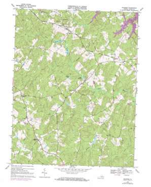
Buckner Topo Map Virginia
To zoom in, hover over the map of Buckner
USGS Topo Quad 37077h7 - 1:24,000 scale
| Topo Map Name: | Buckner |
| USGS Topo Quad ID: | 37077h7 |
| Print Size: | ca. 21 1/4" wide x 27" high |
| Southeast Coordinates: | 37.875° N latitude / 77.75° W longitude |
| Map Center Coordinates: | 37.9375° N latitude / 77.8125° W longitude |
| U.S. State: | VA |
| Filename: | o37077h7.jpg |
| Download Map JPG Image: | Buckner topo map 1:24,000 scale |
| Map Type: | Topographic |
| Topo Series: | 7.5´ |
| Map Scale: | 1:24,000 |
| Source of Map Images: | United States Geological Survey (USGS) |
| Alternate Map Versions: |
Buckner VA 1942, updated 1961 Download PDF Buy paper map Buckner VA 1968, updated 1970 Download PDF Buy paper map Buckner VA 1968, updated 1974 Download PDF Buy paper map Buckner VA 1968, updated 1984 Download PDF Buy paper map Buckner VA 2010 Download PDF Buy paper map Buckner VA 2013 Download PDF Buy paper map Buckner VA 2016 Download PDF Buy paper map |
1:24,000 Topo Quads surrounding Buckner
> Back to 37077e1 at 1:100,000 scale
> Back to 37076a1 at 1:250,000 scale
> Back to U.S. Topo Maps home
Buckner topo map: Gazetteer
Buckner: Airports
Mostly Harmless Heliport elevation 100m 328′Buckner: Dams
Bears Den Dam elevation 85m 278′Chisholm Dam elevation 84m 275′
Dam Number 4 elevation 84m 275′
Goodwins Dam elevation 79m 259′
Little River Number Four Dam elevation 84m 275′
Pettit Dam elevation 81m 265′
Swifts Dam elevation 71m 232′
Buckner: Islands
Robbies Island elevation 76m 249′Buckner: Populated Places
Buckner elevation 100m 328′Gardners Crossroads elevation 107m 351′
Longcreek (historical) elevation 101m 331′
Mount Garland elevation 100m 328′
Threemile Corner elevation 115m 377′
Wickham Corner elevation 104m 341′
Buckner: Post Offices
Buckner Post Office elevation 107m 351′Fredericks Hall Post Office elevation 113m 370′
Gardners Crossroads Post Office elevation 113m 370′
Long Creek Post Office (historical) elevation 106m 347′
Buckner: Reservoirs
Bearden Pond elevation 77m 252′Bears Den Lake elevation 85m 278′
Chisholm Lake elevation 84m 275′
Goodwin Lake elevation 79m 259′
Goodwins Lake elevation 82m 269′
Pettit Lake elevation 81m 265′
Sherman Lake elevation 81m 265′
Spicers Lake elevation 88m 288′
Swift Millpond elevation 71m 232′
Swifts Millpond elevation 74m 242′
Buckner: Streams
Coleman Creek elevation 76m 249′Hawkins Creek elevation 66m 216′
Horsepen Branch elevation 72m 236′
Long Creek elevation 71m 232′
North Fork Little River elevation 72m 236′
Buckner digital topo map on disk
Buy this Buckner topo map showing relief, roads, GPS coordinates and other geographical features, as a high-resolution digital map file on DVD:
Atlantic Coast (NY, NJ, PA, DE, MD, VA, NC)
Buy digital topo maps: Atlantic Coast (NY, NJ, PA, DE, MD, VA, NC)


