Crewe West Topo Map Virginia
To zoom in, hover over the map of Crewe West
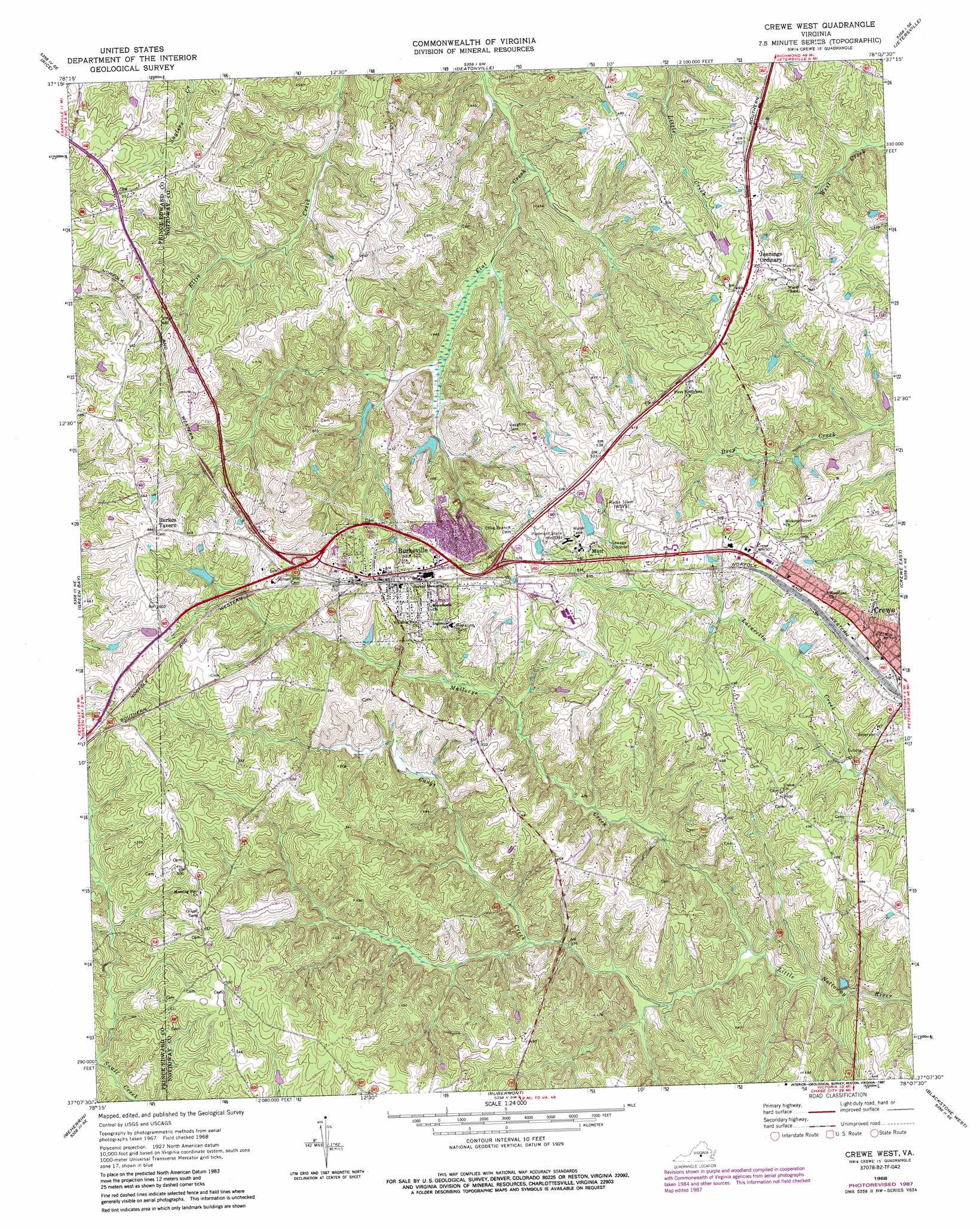
USGS Topo Quad 37078b2 - 1:24,000 scale
| Topo Map Name: | Crewe West |
| USGS Topo Quad ID: | 37078b2 |
| Print Size: | ca. 21 1/4" wide x 27" high |
| Southeast Coordinates: | 37.125° N latitude / 78.125° W longitude |
| Map Center Coordinates: | 37.1875° N latitude / 78.1875° W longitude |
| U.S. State: | VA |
| Filename: | o37078b2.jpg |
| Download Map JPG Image: | Crewe West topo map 1:24,000 scale |
| Map Type: | Topographic |
| Topo Series: | 7.5´ |
| Map Scale: | 1:24,000 |
| Source of Map Images: | United States Geological Survey (USGS) |
| Alternate Map Versions: |
Crewe West VA 1968, updated 1972 Download PDF Buy paper map Crewe West VA 1968, updated 1977 Download PDF Buy paper map Crewe West VA 1968, updated 1987 Download PDF Buy paper map Crewe West VA 2010 Download PDF Buy paper map Crewe West VA 2013 Download PDF Buy paper map Crewe West VA 2016 Download PDF Buy paper map |
1:24,000 Topo Quads surrounding Crewe West
Willis Mountain |
Hillcrest |
Cumberland |
Ballsville |
Chula |
Farmville |
Rice |
Deatonville |
Jetersville |
Amelia Court House |
Hampden Sydney |
Green Bay |
Crewe West |
Crewe East |
Wellville |
Keysville |
Meherrin |
Rubermont |
Blackstone West |
Blackstone East |
Fort Mitchell |
Lunenburg |
Kenbridge West |
Kenbridge East |
Danieltown |
> Back to 37078a1 at 1:100,000 scale
> Back to 37078a1 at 1:250,000 scale
> Back to U.S. Topo Maps home
Crewe West topo map: Gazetteer
Crewe West: Dams
Lush Dam elevation 137m 449′Piedmont State Hospital Dam elevation 148m 485′
Crewe West: Populated Places
Burkes Tavern elevation 177m 580′Burkeville elevation 158m 518′
Jennings Ordinary elevation 153m 501′
Mutt elevation 154m 505′
Oliveville elevation 167m 547′
Crewe West: Streams
Carys Creek elevation 103m 337′Mallorys Creek elevation 104m 341′
Crewe West digital topo map on disk
Buy this Crewe West topo map showing relief, roads, GPS coordinates and other geographical features, as a high-resolution digital map file on DVD:
Western Virginia & Southern West Virginia
Buy digital topo maps: Western Virginia & Southern West Virginia