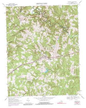
Prospect Topo Map Virginia
To zoom in, hover over the map of Prospect
USGS Topo Quad 37078c5 - 1:24,000 scale
| Topo Map Name: | Prospect |
| USGS Topo Quad ID: | 37078c5 |
| Print Size: | ca. 21 1/4" wide x 27" high |
| Southeast Coordinates: | 37.25° N latitude / 78.5° W longitude |
| Map Center Coordinates: | 37.3125° N latitude / 78.5625° W longitude |
| U.S. State: | VA |
| Filename: | o37078c5.jpg |
| Download Map JPG Image: | Prospect topo map 1:24,000 scale |
| Map Type: | Topographic |
| Topo Series: | 7.5´ |
| Map Scale: | 1:24,000 |
| Source of Map Images: | United States Geological Survey (USGS) |
| Alternate Map Versions: |
Prospect VA 1967, updated 1972 Download PDF Buy paper map Prospect VA 1967, updated 1975 Download PDF Buy paper map Prospect VA 1967, updated 1991 Download PDF Buy paper map Prospect VA 2010 Download PDF Buy paper map Prospect VA 2013 Download PDF Buy paper map Prospect VA 2016 Download PDF Buy paper map |
1:24,000 Topo Quads surrounding Prospect
> Back to 37078a1 at 1:100,000 scale
> Back to 37078a1 at 1:250,000 scale
> Back to U.S. Topo Maps home
Prospect topo map: Gazetteer
Prospect: Bridges
Venables Bridge elevation 100m 328′Prospect: Crossings
Beazley Ford elevation 107m 351′Prospect: Dams
Brisentines Dam elevation 156m 511′Buffalo Creek Number One Dam elevation 142m 465′
Carter Dam elevation 125m 410′
Orange Dam elevation 129m 423′
Prospect: Populated Places
Allens Mill elevation 164m 538′Elam elevation 210m 688′
Hurtsville elevation 196m 643′
Prospect elevation 175m 574′
Prospect: Reservoirs
Brisentine Pond elevation 156m 511′Grand View Lake elevation 142m 465′
Prospect: Streams
Cabin Branch elevation 118m 387′Camp Branch elevation 100m 328′
Ducker Creek elevation 102m 334′
Harris Creek elevation 100m 328′
Plum Creek elevation 104m 341′
Rattler Branch elevation 156m 511′
Spring Branch elevation 115m 377′
Vaughans Creek elevation 106m 347′
Prospect digital topo map on disk
Buy this Prospect topo map showing relief, roads, GPS coordinates and other geographical features, as a high-resolution digital map file on DVD:
Western Virginia & Southern West Virginia
Buy digital topo maps: Western Virginia & Southern West Virginia


