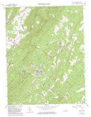
Schuyler Topo Map Virginia
To zoom in, hover over the map of Schuyler
USGS Topo Quad 37078g6 - 1:24,000 scale
| Topo Map Name: | Schuyler |
| USGS Topo Quad ID: | 37078g6 |
| Print Size: | ca. 21 1/4" wide x 27" high |
| Southeast Coordinates: | 37.75° N latitude / 78.625° W longitude |
| Map Center Coordinates: | 37.8125° N latitude / 78.6875° W longitude |
| U.S. State: | VA |
| Filename: | o37078g6.jpg |
| Download Map JPG Image: | Schuyler topo map 1:24,000 scale |
| Map Type: | Topographic |
| Topo Series: | 7.5´ |
| Map Scale: | 1:24,000 |
| Source of Map Images: | United States Geological Survey (USGS) |
| Alternate Map Versions: |
Schuyler VA 1967, updated 1968 Download PDF Buy paper map Schuyler VA 1967, updated 1975 Download PDF Buy paper map Schuyler VA 1967, updated 1982 Download PDF Buy paper map Schuyler VA 1979, updated 1982 Download PDF Buy paper map Schuyler VA 2010 Download PDF Buy paper map Schuyler VA 2013 Download PDF Buy paper map Schuyler VA 2016 Download PDF Buy paper map |
1:24,000 Topo Quads surrounding Schuyler
> Back to 37078e1 at 1:100,000 scale
> Back to 37078a1 at 1:250,000 scale
> Back to U.S. Topo Maps home
Schuyler topo map: Gazetteer
Schuyler: Airports
Faber Airport elevation 193m 633′Schuyler: Crossings
Curds Ford elevation 110m 360′Moses Crossing elevation 131m 429′
Schuyler: Dams
Cove Valley Dam elevation 197m 646′Rockfish River Dam elevation 129m 423′
Schuyler: Populated Places
Bungletown elevation 192m 629′Damon elevation 156m 511′
Faber elevation 181m 593′
Old Dominion elevation 160m 524′
Schuyler elevation 120m 393′
Tillmans elevation 191m 626′
Schuyler: Streams
Bear Creek elevation 164m 538′Briar Fork elevation 119m 390′
Dutch Creek elevation 132m 433′
Green Creek elevation 103m 337′
Harris Creek elevation 108m 354′
Hickory Creek elevation 166m 544′
Hog Creek elevation 102m 334′
Ivy Creek elevation 109m 357′
Rocky Branch elevation 122m 400′
Sheepneck Branch elevation 138m 452′
Schuyler: Summits
Appleberry Mountain elevation 561m 1840′Bailey Mountain elevation 313m 1026′
Brush Mountain elevation 540m 1771′
Butler Mountain elevation 350m 1148′
Green Mountain elevation 245m 803′
Monasco Mountain elevation 415m 1361′
Mount Alto elevation 221m 725′
Shiloh Mountain elevation 356m 1167′
Schuyler digital topo map on disk
Buy this Schuyler topo map showing relief, roads, GPS coordinates and other geographical features, as a high-resolution digital map file on DVD:
Western Virginia & Southern West Virginia
Buy digital topo maps: Western Virginia & Southern West Virginia


