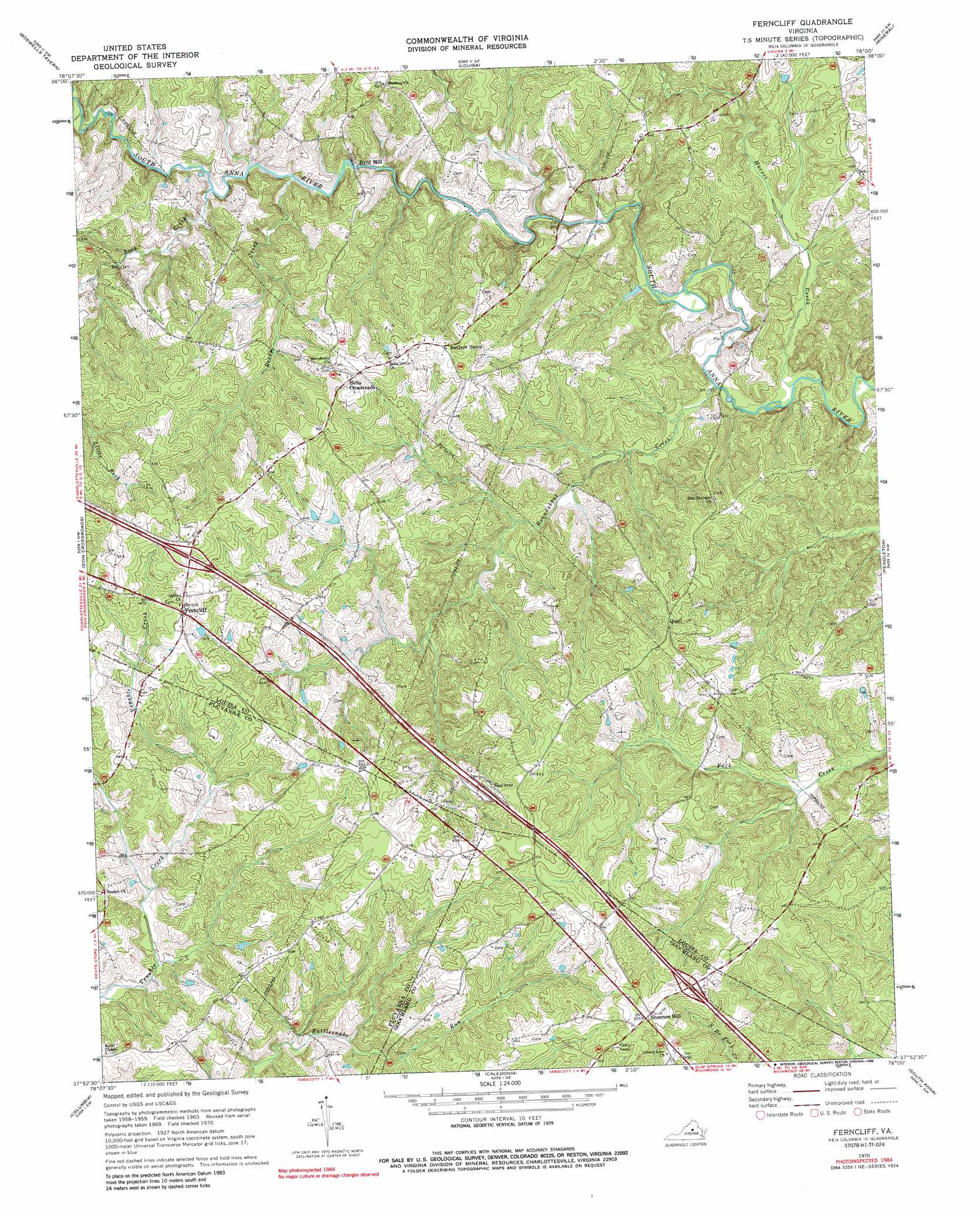
Ferncliff Topo Map Virginia
To zoom in, hover over the map of Ferncliff
USGS Topo Quad 37078h1 - 1:24,000 scale
| Topo Map Name: | Ferncliff |
| USGS Topo Quad ID: | 37078h1 |
| Print Size: | ca. 21 1/4" wide x 27" high |
| Southeast Coordinates: | 37.875° N latitude / 78° W longitude |
| Map Center Coordinates: | 37.9375° N latitude / 78.0625° W longitude |
| U.S. State: | VA |
| Filename: | o37078h1.jpg |
| Download Map JPG Image: | Ferncliff topo map 1:24,000 scale |
| Map Type: | Topographic |
| Topo Series: | 7.5´ |
| Map Scale: | 1:24,000 |
| Source of Map Images: | United States Geological Survey (USGS) |
| Alternate Map Versions: |
Ferncliff VA 1970, updated 1972 Download PDF Buy paper map Ferncliff VA 1970, updated 1988 Download PDF Buy paper map Ferncliff VA 1970, updated 1988 Download PDF Buy paper map Ferncliff VA 2011 Download PDF Buy paper map Ferncliff VA 2013 Download PDF Buy paper map Ferncliff VA 2016 Download PDF Buy paper map |
1:24,000 Topo Quads surrounding Ferncliff
Barboursville |
Gordonsville |
Orange |
Lahore |
Belmont |
Keswick |
Boswells Tavern |
Louisa |
Mineral |
Lake Anna West |
Boyd Tavern |
Zion Crossroads |
Ferncliff |
Pendleton |
Buckner |
Palmyra |
Columbia |
Caledonia |
South Anna |
Dabneys |
Arvonia |
Lakeside Village |
Cartersville |
Goochland |
Perkinsville |
> Back to 37078e1 at 1:100,000 scale
> Back to 37078a1 at 1:250,000 scale
> Back to U.S. Topo Maps home
Ferncliff topo map: Gazetteer
Ferncliff: Crossings
Interchange 143 elevation 159m 521′Interchange 148 elevation 152m 498′
Ferncliff: Dams
Byrd Mill Dam elevation 84m 275′Ferncliff: Populated Places
Bells Crossroads elevation 151m 495′Byrd Mill elevation 90m 295′
Dunreath (historical) elevation 120m 393′
Ferncliff elevation 152m 498′
Quail elevation 146m 479′
Shannon Hill elevation 157m 515′
Shannon Hills elevation 156m 511′
Shannon Hills Estates elevation 146m 479′
Ferncliff: Reservoirs
Byrd Millpond elevation 84m 275′Ferncliff: Streams
Fosters Creek elevation 97m 318′Harris Creek elevation 83m 272′
Reedy Creek elevation 95m 311′
Rock Creek elevation 96m 314′
Roundabout Creek elevation 85m 278′
Ferncliff digital topo map on disk
Buy this Ferncliff topo map showing relief, roads, GPS coordinates and other geographical features, as a high-resolution digital map file on DVD:
Western Virginia & Southern West Virginia
Buy digital topo maps: Western Virginia & Southern West Virginia