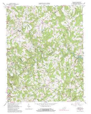
Redwood Topo Map Virginia
To zoom in, hover over the map of Redwood
USGS Topo Quad 37079a7 - 1:24,000 scale
| Topo Map Name: | Redwood |
| USGS Topo Quad ID: | 37079a7 |
| Print Size: | ca. 21 1/4" wide x 27" high |
| Southeast Coordinates: | 37° N latitude / 79.75° W longitude |
| Map Center Coordinates: | 37.0625° N latitude / 79.8125° W longitude |
| U.S. State: | VA |
| Filename: | o37079a7.jpg |
| Download Map JPG Image: | Redwood topo map 1:24,000 scale |
| Map Type: | Topographic |
| Topo Series: | 7.5´ |
| Map Scale: | 1:24,000 |
| Source of Map Images: | United States Geological Survey (USGS) |
| Alternate Map Versions: |
Redwood VA 1963, updated 1965 Download PDF Buy paper map Redwood VA 1963, updated 1979 Download PDF Buy paper map Redwood VA 1963, updated 1983 Download PDF Buy paper map Redwood VA 1963, updated 1985 Download PDF Buy paper map Redwood VA 2012 Download PDF Buy paper map Redwood VA 2013 Download PDF Buy paper map Redwood VA 2016 Download PDF Buy paper map |
1:24,000 Topo Quads surrounding Redwood
> Back to 37079a1 at 1:100,000 scale
> Back to 37078a1 at 1:250,000 scale
> Back to U.S. Topo Maps home
Redwood topo map: Gazetteer
Redwood: Airports
Burnt Chimney Airport elevation 311m 1020′Redwood: Bridges
Brooks Mill Bridge elevation 241m 790′Redwood: Crossings
Brooks Ford elevation 241m 790′Smith Ford elevation 243m 797′
Redwood: Dams
Sunset Lake Dam elevation 308m 1010′Redwood: Populated Places
Burnt Chimney elevation 344m 1128′Crossroads elevation 326m 1069′
Dillons Mill elevation 279m 915′
Felicia (historical) elevation 256m 839′
Piedmont Mill elevation 286m 938′
Redwood elevation 353m 1158′
Villa (historical) elevation 266m 872′
Redwood: Reservoirs
Sunset Lake elevation 308m 1010′Redwood: Ridges
Timber Ridge elevation 369m 1210′Redwood: Streams
Dillons Mill Branch elevation 243m 797′Foul Ground Creek elevation 241m 790′
Little Ellie Creek elevation 278m 912′
Maggodee Creek elevation 261m 856′
Maple Branch elevation 262m 859′
Mollie Branch elevation 286m 938′
Powder Mill Creek elevation 274m 898′
Redwood: Summits
Flint Hill elevation 330m 1082′Preston Knob elevation 397m 1302′
Redwood digital topo map on disk
Buy this Redwood topo map showing relief, roads, GPS coordinates and other geographical features, as a high-resolution digital map file on DVD:
Western Virginia & Southern West Virginia
Buy digital topo maps: Western Virginia & Southern West Virginia


