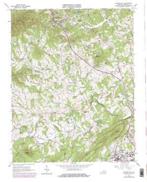
Boones Mill Topo Map Virginia
To zoom in, hover over the map of Boones Mill
USGS Topo Quad 37079a8 - 1:24,000 scale
| Topo Map Name: | Boones Mill |
| USGS Topo Quad ID: | 37079a8 |
| Print Size: | ca. 21 1/4" wide x 27" high |
| Southeast Coordinates: | 37° N latitude / 79.875° W longitude |
| Map Center Coordinates: | 37.0625° N latitude / 79.9375° W longitude |
| U.S. State: | VA |
| Filename: | o37079a8.jpg |
| Download Map JPG Image: | Boones Mill topo map 1:24,000 scale |
| Map Type: | Topographic |
| Topo Series: | 7.5´ |
| Map Scale: | 1:24,000 |
| Source of Map Images: | United States Geological Survey (USGS) |
| Alternate Map Versions: |
Boones Mill VA 1963, updated 1965 Download PDF Buy paper map Boones Mill VA 1963, updated 1978 Download PDF Buy paper map Boones Mill VA 1963, updated 1978 Download PDF Buy paper map Boones Mill VA 2011 Download PDF Buy paper map Boones Mill VA 2013 Download PDF Buy paper map Boones Mill VA 2016 Download PDF Buy paper map |
1:24,000 Topo Quads surrounding Boones Mill
> Back to 37079a1 at 1:100,000 scale
> Back to 37078a1 at 1:250,000 scale
> Back to U.S. Topo Maps home
Boones Mill topo map: Gazetteer
Boones Mill: Bridges
W N Angle Memorial Bridge elevation 353m 1158′Boones Mill: Dams
Melody Dam elevation 360m 1181′Boones Mill: Populated Places
Boones Mill elevation 346m 1135′Claiborn (historical) elevation 357m 1171′
Dugwell elevation 380m 1246′
Gogginsville elevation 373m 1223′
Helm elevation 372m 1220′
Hickman elevation 338m 1108′
Taylor elevation 367m 1204′
Wirtz elevation 335m 1099′
Boones Mill: Reservoirs
Melody Lake elevation 360m 1181′Boones Mill: Streams
Buck Run elevation 323m 1059′Coles Creek elevation 329m 1079′
Hay Run elevation 324m 1062′
Little Creek elevation 303m 994′
Madcap Creek elevation 333m 1092′
Maple Branch elevation 333m 1092′
Teels Creek elevation 316m 1036′
White Oak Creek elevation 311m 1020′
Boones Mill: Summits
Bunker Hill elevation 430m 1410′Clower Knob elevation 417m 1368′
Coles Knob elevation 550m 1804′
Grassy Hill elevation 520m 1706′
Little Mountain elevation 487m 1597′
Boones Mill digital topo map on disk
Buy this Boones Mill topo map showing relief, roads, GPS coordinates and other geographical features, as a high-resolution digital map file on DVD:
Western Virginia & Southern West Virginia
Buy digital topo maps: Western Virginia & Southern West Virginia


