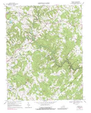
Moneta Topo Map Virginia
To zoom in, hover over the map of Moneta
USGS Topo Quad 37079b5 - 1:24,000 scale
| Topo Map Name: | Moneta |
| USGS Topo Quad ID: | 37079b5 |
| Print Size: | ca. 21 1/4" wide x 27" high |
| Southeast Coordinates: | 37.125° N latitude / 79.5° W longitude |
| Map Center Coordinates: | 37.1875° N latitude / 79.5625° W longitude |
| U.S. State: | VA |
| Filename: | o37079b5.jpg |
| Download Map JPG Image: | Moneta topo map 1:24,000 scale |
| Map Type: | Topographic |
| Topo Series: | 7.5´ |
| Map Scale: | 1:24,000 |
| Source of Map Images: | United States Geological Survey (USGS) |
| Alternate Map Versions: |
Moneta VA 1967, updated 1969 Download PDF Buy paper map Moneta VA 1967, updated 1985 Download PDF Buy paper map Moneta VA 1967, updated 1989 Download PDF Buy paper map Moneta VA 2010 Download PDF Buy paper map Moneta VA 2013 Download PDF Buy paper map Moneta VA 2016 Download PDF Buy paper map |
1:24,000 Topo Quads surrounding Moneta
> Back to 37079a1 at 1:100,000 scale
> Back to 37078a1 at 1:250,000 scale
> Back to U.S. Topo Maps home
Moneta topo map: Gazetteer
Moneta: Airports
Johnson Airport elevation 266m 872′Moneta: Bridges
Haden Bridge elevation 183m 600′Moneta: Dams
Saunders Pond Dam elevation 283m 928′Spring Dam elevation 271m 889′
Moneta: Flats
The Meadows of Goose Creek elevation 232m 761′Moneta: Populated Places
Davis Mill elevation 233m 764′Fancy Grove (historical) elevation 270m 885′
Moneta elevation 262m 859′
Radford elevation 312m 1023′
Moneta: Reservoirs
Saunders Pond elevation 274m 898′Sounders Pond elevation 274m 898′
Spring Lake elevation 271m 889′
Moneta: Ridges
Meadow Ridge elevation 264m 866′Moneta: Streams
Body Camp Creek elevation 190m 623′Bold Branch elevation 179m 587′
Clover Creek elevation 200m 656′
Creasey Mill Creek elevation 178m 583′
Difficult Creek elevation 181m 593′
Harvey Creek elevation 202m 662′
Hunting Creek elevation 228m 748′
Mattox Creek elevation 229m 751′
Mill Creek elevation 196m 643′
Mob Creek elevation 204m 669′
Rockcastle Creek elevation 177m 580′
Shoulder Run elevation 222m 728′
Trough Run elevation 221m 725′
Moneta: Summits
Stone Mountain elevation 343m 1125′Moneta: Valleys
Dark Hollow elevation 242m 793′Moneta digital topo map on disk
Buy this Moneta topo map showing relief, roads, GPS coordinates and other geographical features, as a high-resolution digital map file on DVD:
Western Virginia & Southern West Virginia
Buy digital topo maps: Western Virginia & Southern West Virginia


