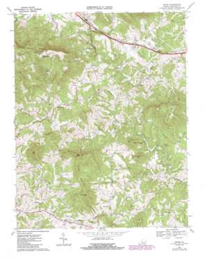
Irving Topo Map Virginia
To zoom in, hover over the map of Irving
USGS Topo Quad 37079c6 - 1:24,000 scale
| Topo Map Name: | Irving |
| USGS Topo Quad ID: | 37079c6 |
| Print Size: | ca. 21 1/4" wide x 27" high |
| Southeast Coordinates: | 37.25° N latitude / 79.625° W longitude |
| Map Center Coordinates: | 37.3125° N latitude / 79.6875° W longitude |
| U.S. State: | VA |
| Filename: | o37079c6.jpg |
| Download Map JPG Image: | Irving topo map 1:24,000 scale |
| Map Type: | Topographic |
| Topo Series: | 7.5´ |
| Map Scale: | 1:24,000 |
| Source of Map Images: | United States Geological Survey (USGS) |
| Alternate Map Versions: |
Irving VA 1967, updated 1969 Download PDF Buy paper map Irving VA 1967, updated 1970 Download PDF Buy paper map Irving VA 1967, updated 1977 Download PDF Buy paper map Irving VA 1967, updated 1986 Download PDF Buy paper map Irving VA 2010 Download PDF Buy paper map Irving VA 2013 Download PDF Buy paper map Irving VA 2016 Download PDF Buy paper map |
1:24,000 Topo Quads surrounding Irving
> Back to 37079a1 at 1:100,000 scale
> Back to 37078a1 at 1:250,000 scale
> Back to U.S. Topo Maps home
Irving topo map: Gazetteer
Irving: Crossings
Rocky Ford elevation 235m 770′Irving: Populated Places
Chamblissburg elevation 329m 1079′Coonsville (historical) elevation 257m 843′
Flint Hill elevation 306m 1003′
Irving elevation 299m 980′
Shady Grove elevation 326m 1069′
Union elevation 307m 1007′
Irving: Streams
Bore Auger Creek elevation 235m 770′Cragged Branch elevation 249m 816′
East Fork Beaverdam Creek elevation 262m 859′
Elk Creek elevation 223m 731′
Enochs Creek elevation 224m 734′
Lick Run elevation 243m 797′
Middle Fork Beaverdam Creek elevation 266m 872′
North Fork Goose Creek elevation 272m 892′
Reed Creek elevation 241m 790′
Shockoe Creek elevation 237m 777′
South Fork Goose Creek elevation 272m 892′
Irving: Summits
Bramletts Mountain elevation 484m 1587′Green Mountain elevation 440m 1443′
High Knob elevation 514m 1686′
Lick Mountain elevation 545m 1788′
Peach Orchard Mountain elevation 314m 1030′
Pilot Mountain elevation 446m 1463′
Porter Mountain elevation 744m 2440′
Thaxton Mountain elevation 586m 1922′
Wiggington Knob elevation 744m 2440′
Zimmerman Mountain elevation 426m 1397′
Irving digital topo map on disk
Buy this Irving topo map showing relief, roads, GPS coordinates and other geographical features, as a high-resolution digital map file on DVD:
Western Virginia & Southern West Virginia
Buy digital topo maps: Western Virginia & Southern West Virginia


