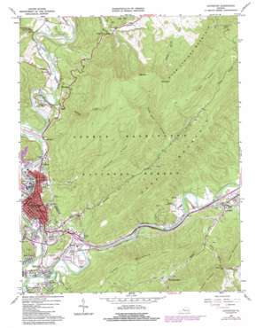
Covington Topo Map Virginia
To zoom in, hover over the map of Covington
USGS Topo Quad 37079g8 - 1:24,000 scale
| Topo Map Name: | Covington |
| USGS Topo Quad ID: | 37079g8 |
| Print Size: | ca. 21 1/4" wide x 27" high |
| Southeast Coordinates: | 37.75° N latitude / 79.875° W longitude |
| Map Center Coordinates: | 37.8125° N latitude / 79.9375° W longitude |
| U.S. State: | VA |
| Filename: | o37079g8.jpg |
| Download Map JPG Image: | Covington topo map 1:24,000 scale |
| Map Type: | Topographic |
| Topo Series: | 7.5´ |
| Map Scale: | 1:24,000 |
| Source of Map Images: | United States Geological Survey (USGS) |
| Alternate Map Versions: |
Covington VA 1962, updated 1964 Download PDF Buy paper map Covington VA 1962, updated 1971 Download PDF Buy paper map Covington VA 1962, updated 1984 Download PDF Buy paper map Covington VA 1962, updated 1984 Download PDF Buy paper map Covington VA 2011 Download PDF Buy paper map Covington VA 2013 Download PDF Buy paper map Covington VA 2016 Download PDF Buy paper map |
| FStopo: | US Forest Service topo Covington is available: Download FStopo PDF Download FStopo TIF |
1:24,000 Topo Quads surrounding Covington
> Back to 37079e1 at 1:100,000 scale
> Back to 37078a1 at 1:250,000 scale
> Back to U.S. Topo Maps home
Covington topo map: Gazetteer
Covington: Airports
Alleghany Regional Hospital Heliport elevation 345m 1131′Clifton Forge-Covington Airport (historical) elevation 339m 1112′
Covington: Crossings
Interchange 14 elevation 376m 1233′Interchange 16 elevation 377m 1236′
Interchange 21 elevation 341m 1118′
Covington: Falls
Falling Spring Falls elevation 627m 2057′Covington: Forests
James River Ranger District elevation 475m 1558′Covington: Gaps
White Rock Gap elevation 443m 1453′Covington: Parks
Covington Historic District elevation 376m 1233′Covington: Populated Places
Clearwater Park elevation 423m 1387′Covington elevation 381m 1250′
Edgemont elevation 386m 1266′
Fairlawn elevation 427m 1400′
Harrington elevation 466m 1528′
Idlewilde elevation 403m 1322′
Intervale elevation 409m 1341′
Low Moor elevation 342m 1122′
Mallow elevation 375m 1230′
Parrish Court elevation 374m 1227′
Rayon Terrace elevation 375m 1230′
Rich Patch Mines elevation 483m 1584′
Rivermont elevation 390m 1279′
Covington: Post Offices
Covington Post Office elevation 379m 1243′Covington: Ridges
Peters Ridge elevation 883m 2896′Piney Ridge elevation 878m 2880′
Covington: Streams
Dry Run elevation 378m 1240′Dunlap Creek elevation 377m 1236′
Harmon Run elevation 362m 1187′
Indiandraft Creek elevation 399m 1309′
Karnes Creek elevation 348m 1141′
Laurel Branch elevation 362m 1187′
Mill Branch elevation 363m 1190′
Ponding Mill Creek elevation 354m 1161′
Potts Creek elevation 363m 1190′
Roaring Run elevation 400m 1312′
White Rock Creek elevation 385m 1263′
Covington: Summits
Bald Knob elevation 1179m 3868′Big Knob elevation 1237m 4058′
Fore Mountain elevation 892m 2926′
Horse Mountain elevation 793m 2601′
Covington: Valleys
Callaghan Hollow elevation 370m 1213′Dolly Ann Hollow elevation 573m 1879′
Indian Draft elevation 404m 1325′
Covington digital topo map on disk
Buy this Covington topo map showing relief, roads, GPS coordinates and other geographical features, as a high-resolution digital map file on DVD:
Western Virginia & Southern West Virginia
Buy digital topo maps: Western Virginia & Southern West Virginia


