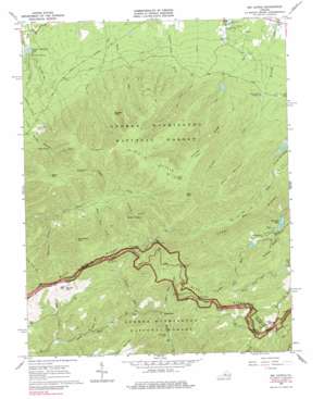
Big Levels Topo Map Virginia
To zoom in, hover over the map of Big Levels
USGS Topo Quad 37079h1 - 1:24,000 scale
| Topo Map Name: | Big Levels |
| USGS Topo Quad ID: | 37079h1 |
| Print Size: | ca. 21 1/4" wide x 27" high |
| Southeast Coordinates: | 37.875° N latitude / 79° W longitude |
| Map Center Coordinates: | 37.9375° N latitude / 79.0625° W longitude |
| U.S. State: | VA |
| Filename: | o37079h1.jpg |
| Download Map JPG Image: | Big Levels topo map 1:24,000 scale |
| Map Type: | Topographic |
| Topo Series: | 7.5´ |
| Map Scale: | 1:24,000 |
| Source of Map Images: | United States Geological Survey (USGS) |
| Alternate Map Versions: |
Big Levels VA 1965, updated 1967 Download PDF Buy paper map Big Levels VA 1965, updated 1977 Download PDF Buy paper map Big Levels VA 1965, updated 1984 Download PDF Buy paper map Big Levels VA 1965, updated 1984 Download PDF Buy paper map Big Levels VA 1999, updated 2000 Download PDF Buy paper map Big Levels VA 2011 Download PDF Buy paper map Big Levels VA 2013 Download PDF Buy paper map Big Levels VA 2016 Download PDF Buy paper map |
| FStopo: | US Forest Service topo Big Levels is available: Download FStopo PDF Download FStopo TIF |
1:24,000 Topo Quads surrounding Big Levels
> Back to 37079e1 at 1:100,000 scale
> Back to 37078a1 at 1:250,000 scale
> Back to U.S. Topo Maps home
Big Levels topo map: Gazetteer
Big Levels: Dams
Coles Run Dam elevation 558m 1830′Sherando Dam elevation 560m 1837′
South River Number 10a Dam elevation 572m 1876′
South River Number 27 Dam elevation 582m 1909′
South River Number Six Dam elevation 486m 1594′
Big Levels: Flats
Big Levels elevation 982m 3221′Big Levels: Gaps
White Rock Gap elevation 776m 2545′Big Levels: Lakes
Green Pond elevation 978m 3208′Lake Quarles elevation 508m 1666′
Mountain Lake elevation 465m 1525′
Big Levels: Mines
Kennedy Mine elevation 634m 2080′Red Mountain Mine elevation 685m 2247′
Big Levels: Populated Places
Love elevation 795m 2608′White Rock elevation 527m 1729′
Big Levels: Reservoirs
Coles Run Reservoir elevation 558m 1830′Rhema Lake elevation 486m 1594′
Sengers Mountain Lake elevation 502m 1646′
Sherando Lake elevation 560m 1837′
Upper Sherando Lake elevation 582m 1909′
Big Levels: Ridges
Kennedy Ridge elevation 932m 3057′Torry Ridge elevation 829m 2719′
Big Levels: Springs
Cold Spring elevation 719m 2358′Big Levels: Streams
Bear Branch elevation 672m 2204′Chimney Branch elevation 716m 2349′
Cold Spring Branch elevation 491m 1610′
Durham Run elevation 583m 1912′
Gum Springs Branch elevation 485m 1591′
Hogback Creek elevation 689m 2260′
Mill Creek elevation 681m 2234′
Mine Bank Creek elevation 668m 2191′
Rankin Run elevation 465m 1525′
Sugartree Branch elevation 583m 1912′
White Rock Creek elevation 522m 1712′
Williams Branch elevation 560m 1837′
Big Levels: Summits
Bald Mountain elevation 1086m 3562′Cellar Mountain elevation 1112m 3648′
Copelands Rocks elevation 903m 2962′
Donald Fauber Mountain elevation 919m 3015′
Flint Mountain elevation 1050m 3444′
Kelley Mountain elevation 1001m 3284′
Knob of Rocks elevation 937m 3074′
Long Drive Mountain elevation 1014m 3326′
Mine Bank Mountain elevation 1063m 3487′
Round Mountain elevation 1051m 3448′
Russell Rock elevation 911m 2988′
Big Levels: Trails
Cold Spring Bald Mountain Trail elevation 1050m 3444′Kennedy Ridge Trail elevation 895m 2936′
Mills Creek Trail elevation 650m 2132′
Stony Run Trail elevation 885m 2903′
White Rock Gap Trail elevation 636m 2086′
Big Levels: Valleys
Wolf Hollow elevation 656m 2152′Big Levels digital topo map on disk
Buy this Big Levels topo map showing relief, roads, GPS coordinates and other geographical features, as a high-resolution digital map file on DVD:
Western Virginia & Southern West Virginia
Buy digital topo maps: Western Virginia & Southern West Virginia


