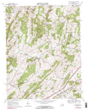
Brownsburg Topo Map Virginia
To zoom in, hover over the map of Brownsburg
USGS Topo Quad 37079h3 - 1:24,000 scale
| Topo Map Name: | Brownsburg |
| USGS Topo Quad ID: | 37079h3 |
| Print Size: | ca. 21 1/4" wide x 27" high |
| Southeast Coordinates: | 37.875° N latitude / 79.25° W longitude |
| Map Center Coordinates: | 37.9375° N latitude / 79.3125° W longitude |
| U.S. State: | VA |
| Filename: | o37079h3.jpg |
| Download Map JPG Image: | Brownsburg topo map 1:24,000 scale |
| Map Type: | Topographic |
| Topo Series: | 7.5´ |
| Map Scale: | 1:24,000 |
| Source of Map Images: | United States Geological Survey (USGS) |
| Alternate Map Versions: |
Brownsburg VA 1967, updated 1969 Download PDF Buy paper map Brownsburg VA 1967, updated 1969 Download PDF Buy paper map Brownsburg VA 2010 Download PDF Buy paper map Brownsburg VA 2013 Download PDF Buy paper map Brownsburg VA 2016 Download PDF Buy paper map |
1:24,000 Topo Quads surrounding Brownsburg
> Back to 37079e1 at 1:100,000 scale
> Back to 37078a1 at 1:250,000 scale
> Back to U.S. Topo Maps home
Brownsburg topo map: Gazetteer
Brownsburg: Crossings
Interchange 200 elevation 539m 1768′Brownsburg: Falls
Gibbs Falls elevation 482m 1581′Brownsburg: Parks
Brownsburg Historic District elevation 424m 1391′Brownsburg: Populated Places
Brownsburg elevation 418m 1371′Bustleburg elevation 376m 1233′
Davis elevation 589m 1932′
Decatur elevation 482m 1581′
Fairfield elevation 494m 1620′
Jonestown elevation 515m 1689′
McClung Mill elevation 385m 1263′
McNutt (historical) elevation 528m 1732′
Mountain View elevation 569m 1866′
Stony Run elevation 544m 1784′
Wades Mill elevation 430m 1410′
Zack elevation 441m 1446′
Brownsburg: Streams
Cedar Creek elevation 377m 1236′Goose Creek elevation 408m 1338′
Moffatts Creek elevation 419m 1374′
Otts Creek elevation 419m 1374′
Pisgah Branch elevation 384m 1259′
Poor Creek elevation 425m 1394′
Brownsburg: Summits
Big Hill elevation 588m 1929′Big Hill elevation 545m 1788′
Burnt Hill elevation 648m 2125′
Dixon Hill elevation 499m 1637′
Hackett Hill elevation 582m 1909′
Laurel Hill elevation 588m 1929′
Lunsford Hill elevation 623m 2043′
Lusk Hill elevation 608m 1994′
Miller Hill elevation 562m 1843′
Newport Hill elevation 590m 1935′
Pisgah Hill elevation 667m 2188′
Roundtop Hill elevation 599m 1965′
White Hill elevation 489m 1604′
Brownsburg digital topo map on disk
Buy this Brownsburg topo map showing relief, roads, GPS coordinates and other geographical features, as a high-resolution digital map file on DVD:
Western Virginia & Southern West Virginia
Buy digital topo maps: Western Virginia & Southern West Virginia


