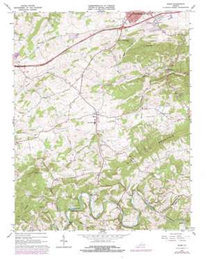
Riner Topo Map Virginia
To zoom in, hover over the map of Riner
USGS Topo Quad 37080a4 - 1:24,000 scale
| Topo Map Name: | Riner |
| USGS Topo Quad ID: | 37080a4 |
| Print Size: | ca. 21 1/4" wide x 27" high |
| Southeast Coordinates: | 37° N latitude / 80.375° W longitude |
| Map Center Coordinates: | 37.0625° N latitude / 80.4375° W longitude |
| U.S. State: | VA |
| Filename: | o37080a4.jpg |
| Download Map JPG Image: | Riner topo map 1:24,000 scale |
| Map Type: | Topographic |
| Topo Series: | 7.5´ |
| Map Scale: | 1:24,000 |
| Source of Map Images: | United States Geological Survey (USGS) |
| Alternate Map Versions: |
Riner VA 1965, updated 1968 Download PDF Buy paper map Riner VA 1965, updated 1978 Download PDF Buy paper map Riner VA 1965, updated 1978 Download PDF Buy paper map Riner VA 2010 Download PDF Buy paper map Riner VA 2013 Download PDF Buy paper map Riner VA 2016 Download PDF Buy paper map |
1:24,000 Topo Quads surrounding Riner
> Back to 37080a1 at 1:100,000 scale
> Back to 37080a1 at 1:250,000 scale
> Back to U.S. Topo Maps home
Riner topo map: Gazetteer
Riner: Bars
Broad Shoals elevation 647m 2122′Riner: Basins
Union Valley elevation 610m 2001′Riner: Bridges
Altizer Bridge elevation 651m 2135′Riner: Crossings
Broad Shoals Ford elevation 651m 2135′Interchange 114 elevation 669m 2194′
Scaggs Ford elevation 638m 2093′
Riner: Dams
Bennetts Dam elevation 612m 2007′Riner: Parks
Riner Historic District elevation 637m 2089′Riner: Populated Places
Atkinson Acres elevation 663m 2175′Canterbury elevation 659m 2162′
Edgewood elevation 691m 2267′
Fairview elevation 605m 1984′
Franklin Park elevation 675m 2214′
Highland Park elevation 674m 2211′
Highview Terrace elevation 664m 2178′
Huff Acres elevation 662m 2171′
Kingston Court elevation 671m 2201′
Lynwood Terrace elevation 659m 2162′
Mockingbird Hill elevation 667m 2188′
Riner elevation 634m 2080′
Rogers elevation 572m 1876′
Rosehill Addition elevation 677m 2221′
Shadeland Addition elevation 670m 2198′
South Hill Park elevation 675m 2214′
Sowers elevation 642m 2106′
Town and Country Estates elevation 671m 2201′
Walnut Grove elevation 674m 2211′
Riner: Streams
Brush Creek elevation 643m 2109′Buck Shoals Branch elevation 637m 2089′
Easter Creek elevation 634m 2080′
Laurel Creek elevation 644m 2112′
Little Camp Creek elevation 638m 2093′
Poplar Branch elevation 615m 2017′
Smith Creek elevation 569m 1866′
Riner: Summits
Calfee Knob elevation 858m 2814′Poorhouse Knob elevation 721m 2365′
Rose Hill elevation 751m 2463′
Riner: Valleys
Kingston Hollow elevation 608m 1994′Riner digital topo map on disk
Buy this Riner topo map showing relief, roads, GPS coordinates and other geographical features, as a high-resolution digital map file on DVD:
Western Virginia & Southern West Virginia
Buy digital topo maps: Western Virginia & Southern West Virginia


