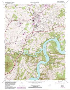
Dublin Topo Map Virginia
To zoom in, hover over the map of Dublin
USGS Topo Quad 37080a6 - 1:24,000 scale
| Topo Map Name: | Dublin |
| USGS Topo Quad ID: | 37080a6 |
| Print Size: | ca. 21 1/4" wide x 27" high |
| Southeast Coordinates: | 37° N latitude / 80.625° W longitude |
| Map Center Coordinates: | 37.0625° N latitude / 80.6875° W longitude |
| U.S. State: | VA |
| Filename: | o37080a6.jpg |
| Download Map JPG Image: | Dublin topo map 1:24,000 scale |
| Map Type: | Topographic |
| Topo Series: | 7.5´ |
| Map Scale: | 1:24,000 |
| Source of Map Images: | United States Geological Survey (USGS) |
| Alternate Map Versions: |
Dublin VA 1965, updated 1966 Download PDF Buy paper map Dublin VA 1965, updated 1973 Download PDF Buy paper map Dublin VA 1965, updated 1977 Download PDF Buy paper map Dublin VA 1965, updated 1984 Download PDF Buy paper map Dublin VA 1965, updated 1984 Download PDF Buy paper map Dublin VA 2010 Download PDF Buy paper map Dublin VA 2013 Download PDF Buy paper map Dublin VA 2016 Download PDF Buy paper map |
1:24,000 Topo Quads surrounding Dublin
> Back to 37080a1 at 1:100,000 scale
> Back to 37080a1 at 1:250,000 scale
> Back to U.S. Topo Maps home
Dublin topo map: Gazetteer
Dublin: Crossings
Interchange 101 elevation 630m 2066′Interchange 94 elevation 636m 2086′
Interchange 98 elevation 626m 2053′
Linkous Ferry (historical) elevation 563m 1847′
Dublin: Parks
Claytor Lake State Park elevation 590m 1935′Dobson Stadium elevation 634m 2080′
Dublin Park elevation 642m 2106′
New River Valley Fairgrounds elevation 660m 2165′
Newbern Historic District elevation 648m 2125′
Dublin: Populated Places
Burlington Mills elevation 659m 2162′Draper elevation 656m 2152′
Dublin elevation 635m 2083′
Highland Park elevation 630m 2066′
McAdam elevation 604m 1981′
Newbern elevation 646m 2119′
Shiloh elevation 634m 2080′
Wurno elevation 610m 2001′
Dublin: Streams
Clapboard Creek elevation 563m 1847′Goose Creek elevation 563m 1847′
Peak Creek elevation 563m 1847′
Thorne Springs Branch elevation 567m 1860′
Dublin: Summits
Draper Mountain elevation 1021m 3349′Peak Knob elevation 1021m 3349′
Dublin: Valleys
Oppossum Hollow elevation 565m 1853′Dublin digital topo map on disk
Buy this Dublin topo map showing relief, roads, GPS coordinates and other geographical features, as a high-resolution digital map file on DVD:
Western Virginia & Southern West Virginia
Buy digital topo maps: Western Virginia & Southern West Virginia


