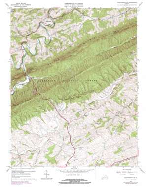
Staffordsville Topo Map Virginia
To zoom in, hover over the map of Staffordsville
USGS Topo Quad 37080b6 - 1:24,000 scale
| Topo Map Name: | Staffordsville |
| USGS Topo Quad ID: | 37080b6 |
| Print Size: | ca. 21 1/4" wide x 27" high |
| Southeast Coordinates: | 37.125° N latitude / 80.625° W longitude |
| Map Center Coordinates: | 37.1875° N latitude / 80.6875° W longitude |
| U.S. State: | VA |
| Filename: | o37080b6.jpg |
| Download Map JPG Image: | Staffordsville topo map 1:24,000 scale |
| Map Type: | Topographic |
| Topo Series: | 7.5´ |
| Map Scale: | 1:24,000 |
| Source of Map Images: | United States Geological Survey (USGS) |
| Alternate Map Versions: |
Staffordsville VA 1965, updated 1966 Download PDF Buy paper map Staffordsville VA 1965, updated 1972 Download PDF Buy paper map Staffordsville VA 1965, updated 1978 Download PDF Buy paper map Staffordsville VA 2011 Download PDF Buy paper map Staffordsville VA 2013 Download PDF Buy paper map Staffordsville VA 2016 Download PDF Buy paper map |
| FStopo: | US Forest Service topo Staffordsville is available: Download FStopo PDF Download FStopo TIF |
1:24,000 Topo Quads surrounding Staffordsville
> Back to 37080a1 at 1:100,000 scale
> Back to 37080a1 at 1:250,000 scale
> Back to U.S. Topo Maps home
Staffordsville topo map: Gazetteer
Staffordsville: Airports
New River Valley Airport elevation 636m 2086′Staffordsville: Mines
Belle Hampton Mine elevation 615m 2017′Staffordsville: Populated Places
Bear Spring elevation 558m 1830′Highland elevation 612m 2007′
Poplar Hill elevation 550m 1804′
Springdale elevation 592m 1942′
Staffordsville elevation 584m 1916′
Trigg elevation 564m 1850′
Wabash (historical) elevation 548m 1797′
Staffordsville: Ridges
Shuffle Ridge elevation 634m 2080′Staffordsville: Streams
Carper Branch elevation 587m 1925′Little Walker Creek elevation 543m 1781′
McGavock Creek elevation 577m 1893′
Millerplace Branch elevation 594m 1948′
Racepath Branch elevation 590m 1935′
Shuffle Branch elevation 542m 1778′
Slabtown Branch elevation 602m 1975′
Wabash Creek elevation 523m 1715′
Whitleys Branch elevation 525m 1722′
Staffordsville: Summits
Cloyds Mountain elevation 825m 2706′Staffordsville: Valleys
Back Hollow elevation 594m 1948′Beaufort Hollow elevation 613m 2011′
Staffordsville digital topo map on disk
Buy this Staffordsville topo map showing relief, roads, GPS coordinates and other geographical features, as a high-resolution digital map file on DVD:
Western Virginia & Southern West Virginia
Buy digital topo maps: Western Virginia & Southern West Virginia


