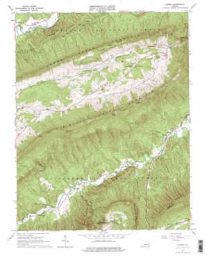
Looney Topo Map Virginia
To zoom in, hover over the map of Looney
USGS Topo Quad 37080d2 - 1:24,000 scale
| Topo Map Name: | Looney |
| USGS Topo Quad ID: | 37080d2 |
| Print Size: | ca. 21 1/4" wide x 27" high |
| Southeast Coordinates: | 37.375° N latitude / 80.125° W longitude |
| Map Center Coordinates: | 37.4375° N latitude / 80.1875° W longitude |
| U.S. State: | VA |
| Filename: | o37080d2.jpg |
| Download Map JPG Image: | Looney topo map 1:24,000 scale |
| Map Type: | Topographic |
| Topo Series: | 7.5´ |
| Map Scale: | 1:24,000 |
| Source of Map Images: | United States Geological Survey (USGS) |
| Alternate Map Versions: |
Looney VA 1963, updated 1965 Download PDF Buy paper map Looney VA 1963, updated 1976 Download PDF Buy paper map Looney VA 1963, updated 1976 Download PDF Buy paper map Looney VA 2011 Download PDF Buy paper map Looney VA 2013 Download PDF Buy paper map Looney VA 2016 Download PDF Buy paper map |
| FStopo: | US Forest Service topo Looney is available: Download FStopo PDF Download FStopo TIF |
1:24,000 Topo Quads surrounding Looney
> Back to 37080a1 at 1:100,000 scale
> Back to 37080a1 at 1:250,000 scale
> Back to U.S. Topo Maps home
Looney topo map: Gazetteer
Looney: Gaps
McAfee Gap elevation 585m 1919′Looney: Populated Places
Abbott elevation 418m 1371′Gunn elevation 489m 1604′
Looney elevation 780m 2559′
Webbs Mill elevation 445m 1459′
Looney: Ridges
Piney Ridge elevation 666m 2185′Looney: Streams
McAfee Run elevation 422m 1384′Mill Creek elevation 443m 1453′
Pickles Branch elevation 487m 1597′
Rocky Branch elevation 489m 1604′
Snodgrass Branch elevation 484m 1587′
Trout Creek elevation 440m 1443′
Turnpike Creek elevation 446m 1463′
Looney: Summits
Aps Knob elevation 880m 2887′Chimney Rock elevation 1108m 3635′
Earn Knob elevation 1097m 3599′
Sinking Creek Mountain elevation 1117m 3664′
Looney: Trails
Trout Creek Appalachian Trail elevation 511m 1676′Looney: Valleys
Lee Hollow elevation 469m 1538′Millers Cove elevation 548m 1797′
Looney digital topo map on disk
Buy this Looney topo map showing relief, roads, GPS coordinates and other geographical features, as a high-resolution digital map file on DVD:
Western Virginia & Southern West Virginia
Buy digital topo maps: Western Virginia & Southern West Virginia


