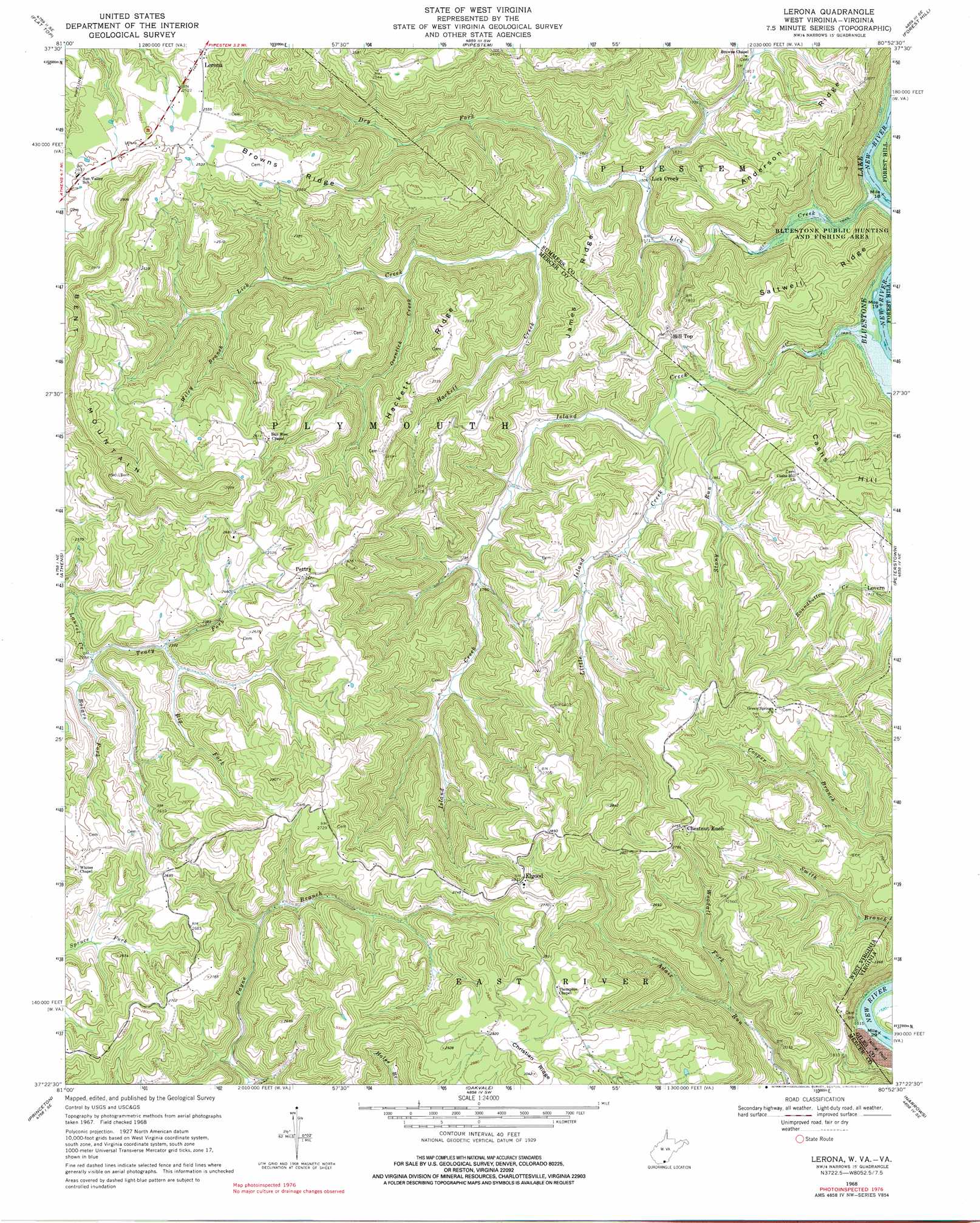
Lerona Topo Map West Virginia
To zoom in, hover over the map of Lerona
USGS Topo Quad 37080d8 - 1:24,000 scale
| Topo Map Name: | Lerona |
| USGS Topo Quad ID: | 37080d8 |
| Print Size: | ca. 21 1/4" wide x 27" high |
| Southeast Coordinates: | 37.375° N latitude / 80.875° W longitude |
| Map Center Coordinates: | 37.4375° N latitude / 80.9375° W longitude |
| U.S. States: | WV, VA |
| Filename: | o37080d8.jpg |
| Download Map JPG Image: | Lerona topo map 1:24,000 scale |
| Map Type: | Topographic |
| Topo Series: | 7.5´ |
| Map Scale: | 1:24,000 |
| Source of Map Images: | United States Geological Survey (USGS) |
| Alternate Map Versions: |
Lerona WV 1968, updated 1972 Download PDF Buy paper map Lerona WV 1968, updated 1977 Download PDF Buy paper map Lerona WV 2011 Download PDF Buy paper map Lerona WV 2014 Download PDF Buy paper map Lerona WV 2016 Download PDF Buy paper map |
1:24,000 Topo Quads surrounding Lerona
Crab Orchard |
Shady Spring |
Hinton |
Talcott |
Alderson |
Odd |
Flat Top |
Pipestem |
Forest Hill |
Greenville |
Matoaka |
Athens |
Lerona |
Peterstown |
Lindside |
Bluefield |
Princeton |
Oakvale |
Narrows |
Pearisburg |
Bastian |
Rocky Gap |
Mechanicsburg |
White Gate |
Staffordsville |
> Back to 37080a1 at 1:100,000 scale
> Back to 37080a1 at 1:250,000 scale
> Back to U.S. Topo Maps home
Lerona topo map: Gazetteer
Lerona: Populated Places
Cashers Hill elevation 648m 2125′Chestnut Knob elevation 838m 2749′
Elgood elevation 858m 2814′
Hill Top elevation 615m 2017′
Lerona elevation 772m 2532′
Lick Creek elevation 491m 1610′
Lovern elevation 563m 1847′
Mercers Saltworks (historical) elevation 447m 1466′
Pettry elevation 784m 2572′
Lerona: Post Offices
Lerona Post Office elevation 770m 2526′Pettry Post Office (historical) elevation 785m 2575′
Lerona: Ridges
Anderson Ridge elevation 656m 2152′Browns Ridge elevation 767m 2516′
Hackett Ridge elevation 699m 2293′
James Ridge elevation 659m 2162′
Saltwell Ridge elevation 630m 2066′
Lerona: Springs
Nash Spring elevation 860m 2821′Lerona: Streams
Big Fork elevation 708m 2322′Bolars Fork elevation 696m 2283′
Dry Fork elevation 485m 1591′
Hackett Creek elevation 493m 1617′
Island Creek elevation 439m 1440′
Lick Creek elevation 438m 1437′
Little Island Creek elevation 509m 1669′
Ovenlick Creek elevation 512m 1679′
Stony Run elevation 502m 1646′
Tracy Fork elevation 696m 2283′
Wiley Branch elevation 565m 1853′
Woodall Fork elevation 584m 1916′
Lerona: Summits
Bent Mountain elevation 940m 3083′Cashs Hill elevation 661m 2168′
Lerona digital topo map on disk
Buy this Lerona topo map showing relief, roads, GPS coordinates and other geographical features, as a high-resolution digital map file on DVD:
Western Virginia & Southern West Virginia
Buy digital topo maps: Western Virginia & Southern West Virginia