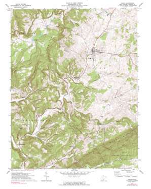
Union Topo Map West Virginia
To zoom in, hover over the map of Union
USGS Topo Quad 37080e5 - 1:24,000 scale
| Topo Map Name: | Union |
| USGS Topo Quad ID: | 37080e5 |
| Print Size: | ca. 21 1/4" wide x 27" high |
| Southeast Coordinates: | 37.5° N latitude / 80.5° W longitude |
| Map Center Coordinates: | 37.5625° N latitude / 80.5625° W longitude |
| U.S. State: | WV |
| Filename: | o37080e5.jpg |
| Download Map JPG Image: | Union topo map 1:24,000 scale |
| Map Type: | Topographic |
| Topo Series: | 7.5´ |
| Map Scale: | 1:24,000 |
| Source of Map Images: | United States Geological Survey (USGS) |
| Alternate Map Versions: |
Union WV 1971, updated 1974 Download PDF Buy paper map Union WV 1971, updated 1991 Download PDF Buy paper map Union WV 2011 Download PDF Buy paper map Union WV 2014 Download PDF Buy paper map Union WV 2016 Download PDF Buy paper map |
1:24,000 Topo Quads surrounding Union
> Back to 37080e1 at 1:100,000 scale
> Back to 37080a1 at 1:250,000 scale
> Back to U.S. Topo Maps home
Union topo map: Gazetteer
Union: Bridges
Indian Creek Covered Bridge elevation 541m 1774′Union: Parks
Salt Sulphur Springs Historic District elevation 549m 1801′Union Historic District elevation 630m 2066′
Union: Populated Places
Knobs elevation 882m 2893′Lillydale elevation 544m 1784′
Raines Corner elevation 518m 1699′
Salt Sulphur Springs elevation 549m 1801′
Union elevation 632m 2073′
Zenith elevation 666m 2185′
Union: Post Offices
Willow Bend Post Office elevation 578m 1896′Union: Ridges
Swoopes Knobs elevation 984m 3228′Union: Springs
Dropping Lick Spring elevation 713m 2339′Iodine Spring elevation 548m 1797′
Jim Ray Spring elevation 653m 2142′
Salt Sulphur Spring elevation 550m 1804′
Sweet Sulphur Spring elevation 546m 1791′
Union: Streams
Burnside Branch elevation 576m 1889′Humphreys Run elevation 522m 1712′
Hunter Branch elevation 542m 1778′
Lick Run elevation 524m 1719′
Manns Creek elevation 584m 1916′
Pepper Run elevation 546m 1791′
Possumtrot Branch elevation 523m 1715′
Rock Camp Creek elevation 514m 1686′
Sarton Branch elevation 655m 2148′
Tackett Branch elevation 574m 1883′
Trotter Branch elevation 586m 1922′
Turkey Creek elevation 538m 1765′
Union: Summits
Calders Peak elevation 981m 3218′Walnut Knob elevation 777m 2549′
Union: Valleys
Earson Hollow elevation 647m 2122′Field Hollow elevation 545m 1788′
Gin Hollow elevation 548m 1797′
Wallace Hollow elevation 649m 2129′
Union digital topo map on disk
Buy this Union topo map showing relief, roads, GPS coordinates and other geographical features, as a high-resolution digital map file on DVD:
Western Virginia & Southern West Virginia
Buy digital topo maps: Western Virginia & Southern West Virginia


