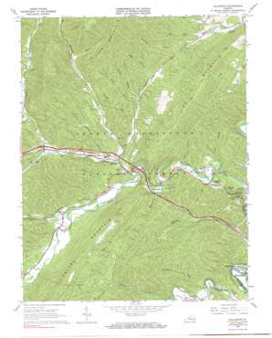
Callaghan Topo Map Virginia
To zoom in, hover over the map of Callaghan
USGS Topo Quad 37080g1 - 1:24,000 scale
| Topo Map Name: | Callaghan |
| USGS Topo Quad ID: | 37080g1 |
| Print Size: | ca. 21 1/4" wide x 27" high |
| Southeast Coordinates: | 37.75° N latitude / 80° W longitude |
| Map Center Coordinates: | 37.8125° N latitude / 80.0625° W longitude |
| U.S. State: | VA |
| Filename: | o37080g1.jpg |
| Download Map JPG Image: | Callaghan topo map 1:24,000 scale |
| Map Type: | Topographic |
| Topo Series: | 7.5´ |
| Map Scale: | 1:24,000 |
| Source of Map Images: | United States Geological Survey (USGS) |
| Alternate Map Versions: |
Callaghan VA 1966, updated 1967 Download PDF Buy paper map Callaghan VA 1966, updated 1967 Download PDF Buy paper map Callaghan VA 2011 Download PDF Buy paper map Callaghan VA 2013 Download PDF Buy paper map Callaghan VA 2016 Download PDF Buy paper map |
| FStopo: | US Forest Service topo Callaghan is available: Download FStopo PDF Download FStopo TIF |
1:24,000 Topo Quads surrounding Callaghan
> Back to 37080e1 at 1:100,000 scale
> Back to 37080a1 at 1:250,000 scale
> Back to U.S. Topo Maps home
Callaghan topo map: Gazetteer
Callaghan: Beaches
Dunlap Beach elevation 399m 1309′Callaghan: Bridges
Humpback Covered Bridge elevation 398m 1305′Callaghan: Crossings
Interchange 10 elevation 425m 1394′Interchange 7 elevation 452m 1482′
Callaghan: Dams
Westvaco Number Two Flyash Lagoon Dam elevation 400m 1312′Callaghan: Parks
Humpback Bridge Wayside elevation 401m 1315′Callaghan: Populated Places
Callaghan elevation 419m 1374′Moss Run elevation 436m 1430′
Oakwood Forest elevation 454m 1489′
Stonewall elevation 414m 1358′
Westwood Place elevation 434m 1423′
Callaghan: Reservoirs
Westvaco Number Two Flyash Lagoon elevation 400m 1312′Callaghan: Streams
Bennets Run elevation 365m 1197′Big Lick elevation 460m 1509′
Big Run elevation 460m 1509′
Cove Run elevation 407m 1335′
Dry Branch elevation 418m 1371′
Johns Run elevation 376m 1233′
Johnsons Creek elevation 415m 1361′
Laurel Branch elevation 388m 1272′
Moss Run elevation 424m 1391′
Ogle Creek elevation 409m 1341′
South Fork Ogle Creek elevation 444m 1456′
Spring Branch elevation 510m 1673′
Straight Run elevation 450m 1476′
Thorny Branch elevation 415m 1361′
Callaghan: Summits
Lick Mountain elevation 893m 2929′Lukes Mountain elevation 490m 1607′
Callaghan: Tunnels
Mud Tunnel elevation 492m 1614′Callaghan: Valleys
Anderson Hollow elevation 467m 1532′Bear Hollow elevation 499m 1637′
Cook Hollow elevation 459m 1505′
Ford Hollow elevation 377m 1236′
Goff Hollow elevation 436m 1430′
Jones Hollow elevation 497m 1630′
Kittenger Hollow elevation 463m 1519′
Sawmill Hollow elevation 463m 1519′
Callaghan digital topo map on disk
Buy this Callaghan topo map showing relief, roads, GPS coordinates and other geographical features, as a high-resolution digital map file on DVD:
Western Virginia & Southern West Virginia
Buy digital topo maps: Western Virginia & Southern West Virginia


