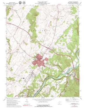
Lewisburg Topo Map West Virginia
To zoom in, hover over the map of Lewisburg
USGS Topo Quad 37080g4 - 1:24,000 scale
| Topo Map Name: | Lewisburg |
| USGS Topo Quad ID: | 37080g4 |
| Print Size: | ca. 21 1/4" wide x 27" high |
| Southeast Coordinates: | 37.75° N latitude / 80.375° W longitude |
| Map Center Coordinates: | 37.8125° N latitude / 80.4375° W longitude |
| U.S. State: | WV |
| Filename: | o37080g4.jpg |
| Download Map JPG Image: | Lewisburg topo map 1:24,000 scale |
| Map Type: | Topographic |
| Topo Series: | 7.5´ |
| Map Scale: | 1:24,000 |
| Source of Map Images: | United States Geological Survey (USGS) |
| Alternate Map Versions: |
Lewisburg WV 1972, updated 1974 Download PDF Buy paper map Lewisburg WV 1972, updated 1979 Download PDF Buy paper map Lewisburg WV 1998, updated 2000 Download PDF Buy paper map Lewisburg WV 2011 Download PDF Buy paper map Lewisburg WV 2014 Download PDF Buy paper map Lewisburg WV 2016 Download PDF Buy paper map |
1:24,000 Topo Quads surrounding Lewisburg
> Back to 37080e1 at 1:100,000 scale
> Back to 37080a1 at 1:250,000 scale
> Back to U.S. Topo Maps home
Lewisburg topo map: Gazetteer
Lewisburg: Airports
Greenbrier Valley Airport elevation 696m 2283′Pratt Mining Heliport elevation 709m 2326′
Lewisburg: Cliffs
Coffman Hill elevation 596m 1955′Lewisburg: Crossings
Interchange 169 elevation 675m 2214′Mathews Ford elevation 505m 1656′
Lewisburg: Parks
Lewisburg Historic District elevation 634m 2080′Maple Street Historic District elevation 672m 2204′
South Church Street Historic District elevation 635m 2083′
Lewisburg: Populated Places
Buckingham Acres elevation 687m 2253′Caldwell elevation 517m 1696′
Cedar Knoll Trailer Park elevation 658m 2158′
Crowfields elevation 685m 2247′
Dogwood Heights elevation 663m 2175′
Fair Oaks Trailer Park elevation 659m 2162′
Fairlea elevation 661m 2168′
Fuller Trailer Park elevation 657m 2155′
Lewisburg elevation 634m 2080′
Maxwelton elevation 725m 2378′
Morlunda elevation 624m 2047′
Mountain View Estates elevation 685m 2247′
North Caldwell elevation 520m 1706′
Richlands elevation 629m 2063′
Rolling Hills elevation 679m 2227′
Teaberry elevation 587m 1925′
Underwood Estates elevation 677m 2221′
Walnut Hills elevation 658m 2158′
Whitcomb (historical) elevation 520m 1706′
Lewisburg: Post Offices
Caldwell Post Office elevation 518m 1699′Lewisburg Post Office elevation 640m 2099′
Maxwelton Post Office elevation 721m 2365′
Lewisburg: Springs
Johnson Spring elevation 621m 2037′Lewis Spring elevation 626m 2053′
Morlunda Farms Spring elevation 626m 2053′
Morlunda Farms Spring elevation 625m 2050′
Lewisburg: Streams
Howard Creek elevation 511m 1676′Milligan Creek elevation 556m 1824′
Lewisburg: Summits
Hominy Hill elevation 686m 2250′Wagner Hill elevation 698m 2290′
Weaver Knob elevation 874m 2867′
Lewisburg: Valleys
Cat Rock Hollow elevation 524m 1719′Monroe Draft elevation 516m 1692′
Lewisburg digital topo map on disk
Buy this Lewisburg topo map showing relief, roads, GPS coordinates and other geographical features, as a high-resolution digital map file on DVD:
Western Virginia & Southern West Virginia
Buy digital topo maps: Western Virginia & Southern West Virginia


