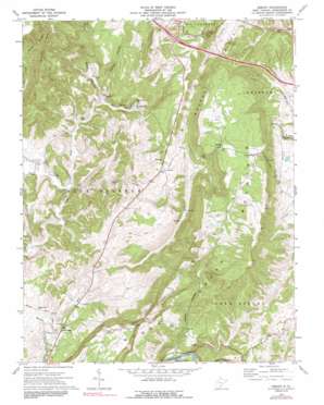
Asbury Topo Map West Virginia
To zoom in, hover over the map of Asbury
USGS Topo Quad 37080g5 - 1:24,000 scale
| Topo Map Name: | Asbury |
| USGS Topo Quad ID: | 37080g5 |
| Print Size: | ca. 21 1/4" wide x 27" high |
| Southeast Coordinates: | 37.75° N latitude / 80.5° W longitude |
| Map Center Coordinates: | 37.8125° N latitude / 80.5625° W longitude |
| U.S. State: | WV |
| Filename: | o37080g5.jpg |
| Download Map JPG Image: | Asbury topo map 1:24,000 scale |
| Map Type: | Topographic |
| Topo Series: | 7.5´ |
| Map Scale: | 1:24,000 |
| Source of Map Images: | United States Geological Survey (USGS) |
| Alternate Map Versions: |
Asbury WV 1964, updated 1984 Download PDF Buy paper map Asbury WV 1972, updated 1974 Download PDF Buy paper map Asbury WV 1972, updated 1991 Download PDF Buy paper map Asbury WV 2011 Download PDF Buy paper map Asbury WV 2014 Download PDF Buy paper map Asbury WV 2016 Download PDF Buy paper map |
1:24,000 Topo Quads surrounding Asbury
> Back to 37080e1 at 1:100,000 scale
> Back to 37080a1 at 1:250,000 scale
> Back to U.S. Topo Maps home
Asbury topo map: Gazetteer
Asbury: Bridges
Herns Mill Bridge elevation 572m 1876′Asbury: Crossings
Interchange 161 elevation 672m 2204′Asbury: Populated Places
Alta elevation 754m 2473′Asbury elevation 643m 2109′
Blaker Mills elevation 514m 1686′
Piercys Mill elevation 506m 1660′
Asbury: Post Offices
Asbury Post Office elevation 640m 2099′Asbury: Ridges
Muddy Creek Mountain elevation 884m 2900′Spotts Ridge elevation 764m 2506′
Asbury: Springs
Big Spring elevation 502m 1646′David Nash Spring elevation 502m 1646′
Davis Spring elevation 548m 1797′
Dye Spring elevation 564m 1850′
Early Spring elevation 521m 1709′
Fleshman Spring elevation 555m 1820′
Fuller Spring elevation 710m 2329′
Harvey Spring elevation 540m 1771′
Jim Fleshman Spring elevation 570m 1870′
Morlunda Farms Spring elevation 611m 2004′
Piercy Spring elevation 506m 1660′
Piercys Cave Spring elevation 509m 1669′
Reynolds Spring elevation 514m 1686′
Seep Spring elevation 495m 1624′
Asbury: Streams
Alum Run elevation 498m 1633′Kitchen Creek elevation 495m 1624′
Mill Creek elevation 491m 1610′
Renick Creek elevation 497m 1630′
Asbury: Valleys
Alum Rock Hollow elevation 499m 1637′Davis Hollow elevation 492m 1614′
Mullins Hollow elevation 499m 1637′
Pigeon Hollow elevation 533m 1748′
Raders Valley elevation 626m 2053′
Asbury digital topo map on disk
Buy this Asbury topo map showing relief, roads, GPS coordinates and other geographical features, as a high-resolution digital map file on DVD:
Western Virginia & Southern West Virginia
Buy digital topo maps: Western Virginia & Southern West Virginia


