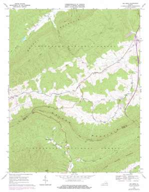
Big Bend Topo Map Virginia
To zoom in, hover over the map of Big Bend
USGS Topo Quad 37081a2 - 1:24,000 scale
| Topo Map Name: | Big Bend |
| USGS Topo Quad ID: | 37081a2 |
| Print Size: | ca. 21 1/4" wide x 27" high |
| Southeast Coordinates: | 37° N latitude / 81.125° W longitude |
| Map Center Coordinates: | 37.0625° N latitude / 81.1875° W longitude |
| U.S. State: | VA |
| Filename: | o37081a2.jpg |
| Download Map JPG Image: | Big Bend topo map 1:24,000 scale |
| Map Type: | Topographic |
| Topo Series: | 7.5´ |
| Map Scale: | 1:24,000 |
| Source of Map Images: | United States Geological Survey (USGS) |
| Alternate Map Versions: |
Big Bend VA 1968, updated 1971 Download PDF Buy paper map Big Bend VA 1968, updated 1978 Download PDF Buy paper map Big Bend VA 2011 Download PDF Buy paper map Big Bend VA 2013 Download PDF Buy paper map Big Bend VA 2016 Download PDF Buy paper map |
| FStopo: | US Forest Service topo Big Bend is available: Download FStopo PDF Download FStopo TIF |
1:24,000 Topo Quads surrounding Big Bend
> Back to 37081a1 at 1:100,000 scale
> Back to 37080a1 at 1:250,000 scale
> Back to U.S. Topo Maps home
Big Bend topo map: Gazetteer
Big Bend: Bends
Big Bend elevation 1179m 3868′Big Bend: Crossings
Interchange 52 elevation 768m 2519′Big Bend: Dams
Crab Orchard Creek Dam elevation 765m 2509′Hunting Camp Dam elevation 720m 2362′
Big Bend: Populated Places
Eagle Oak elevation 820m 2690′Effna elevation 838m 2749′
Suiter elevation 702m 2303′
Big Bend: Reservoirs
Crab Orchard Lake elevation 765m 2509′Big Bend: Ridges
Walker Mountain elevation 1064m 3490′Big Bend: Streams
East Fork Stony Fork elevation 714m 2342′Laurel Creek elevation 696m 2283′
Little Wolf Creek elevation 749m 2457′
Big Bend: Summits
Griffith Knob elevation 1148m 3766′Little Walker Mountain elevation 995m 3264′
Big Bend: Trails
Walker Mountain Trail elevation 1181m 3874′Big Bend: Tunnels
Big Walker Mountain Tunnel elevation 1101m 3612′Big Bend: Valleys
Shewey Valley elevation 835m 2739′Big Bend digital topo map on disk
Buy this Big Bend topo map showing relief, roads, GPS coordinates and other geographical features, as a high-resolution digital map file on DVD:
Western Virginia & Southern West Virginia
Buy digital topo maps: Western Virginia & Southern West Virginia


