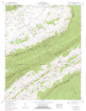
Garden Mountain Topo Map Virginia
To zoom in, hover over the map of Garden Mountain
USGS Topo Quad 37081a3 - 1:24,000 scale
| Topo Map Name: | Garden Mountain |
| USGS Topo Quad ID: | 37081a3 |
| Print Size: | ca. 21 1/4" wide x 27" high |
| Southeast Coordinates: | 37° N latitude / 81.25° W longitude |
| Map Center Coordinates: | 37.0625° N latitude / 81.3125° W longitude |
| U.S. State: | VA |
| Filename: | o37081a3.jpg |
| Download Map JPG Image: | Garden Mountain topo map 1:24,000 scale |
| Map Type: | Topographic |
| Topo Series: | 7.5´ |
| Map Scale: | 1:24,000 |
| Source of Map Images: | United States Geological Survey (USGS) |
| Alternate Map Versions: |
Garden Mountain VA 1935 Download PDF Buy paper map Garden Mountain VA 1958, updated 1960 Download PDF Buy paper map Garden Mountain VA 1958, updated 1960 Download PDF Buy paper map Garden Mountain VA 1958, updated 1975 Download PDF Buy paper map Garden Mountain VA 1958, updated 1983 Download PDF Buy paper map Garden Mountain VA 2011 Download PDF Buy paper map Garden Mountain VA 2013 Download PDF Buy paper map Garden Mountain VA 2016 Download PDF Buy paper map |
| FStopo: | US Forest Service topo Garden Mountain is available: Download FStopo PDF Download FStopo TIF |
1:24,000 Topo Quads surrounding Garden Mountain
> Back to 37081a1 at 1:100,000 scale
> Back to 37080a1 at 1:250,000 scale
> Back to U.S. Topo Maps home
Garden Mountain topo map: Gazetteer
Garden Mountain: Airports
Burkes Garden Airport elevation 948m 3110′Garden Mountain: Basins
Burkes Garden elevation 934m 3064′Medley Valley elevation 961m 3152′
Garden Mountain: Lakes
Gullion Fork Fishing Ponds elevation 790m 2591′Garden Mountain: Parks
Burkes Garden Rural Historic District elevation 937m 3074′Garden Mountain: Populated Places
Burkes Garden elevation 937m 3074′Ceres elevation 787m 2582′
Little Town elevation 940m 3083′
Sharon Springs elevation 828m 2716′
Spracher Place elevation 961m 3152′
Garden Mountain: Post Offices
Burkes Garden Post Office elevation 937m 3074′Garden Mountain: Ridges
Banks Ridge elevation 981m 3218′Big Ridge elevation 881m 2890′
Garden Mountain: Springs
Blue Spring elevation 943m 3093′Fish Spring elevation 930m 3051′
Sharon Springs elevation 841m 2759′
Station Spring elevation 949m 3113′
Garden Mountain: Streams
Blue Spring Creek elevation 929m 3047′Bucks Branch elevation 774m 2539′
Crooked Run elevation 925m 3034′
Gose Branch elevation 924m 3031′
Rhudy Branch elevation 929m 3047′
Snyder Branch elevation 926m 3038′
Soap Creek elevation 775m 2542′
Station Spring Creek elevation 925m 3034′
Garden Mountain: Valleys
Alum Spring Hollow elevation 838m 2749′Foglesong Valley elevation 777m 2549′
Jacobs Hollow elevation 737m 2417′
Laurel Hollow elevation 747m 2450′
Six Hollow elevation 743m 2437′
Garden Mountain digital topo map on disk
Buy this Garden Mountain topo map showing relief, roads, GPS coordinates and other geographical features, as a high-resolution digital map file on DVD:
Western Virginia & Southern West Virginia
Buy digital topo maps: Western Virginia & Southern West Virginia


