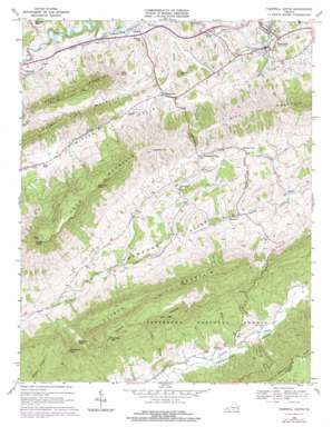
Tazewell South Topo Map Virginia
To zoom in, hover over the map of Tazewell South
USGS Topo Quad 37081a5 - 1:24,000 scale
| Topo Map Name: | Tazewell South |
| USGS Topo Quad ID: | 37081a5 |
| Print Size: | ca. 21 1/4" wide x 27" high |
| Southeast Coordinates: | 37° N latitude / 81.5° W longitude |
| Map Center Coordinates: | 37.0625° N latitude / 81.5625° W longitude |
| U.S. State: | VA |
| Filename: | o37081a5.jpg |
| Download Map JPG Image: | Tazewell South topo map 1:24,000 scale |
| Map Type: | Topographic |
| Topo Series: | 7.5´ |
| Map Scale: | 1:24,000 |
| Source of Map Images: | United States Geological Survey (USGS) |
| Alternate Map Versions: |
Tazewell VA 1934 Download PDF Buy paper map Tazewell South VA 1968, updated 1972 Download PDF Buy paper map Tazewell South VA 1968, updated 1978 Download PDF Buy paper map Tazewell South VA 2011 Download PDF Buy paper map Tazewell South VA 2013 Download PDF Buy paper map Tazewell South VA 2016 Download PDF Buy paper map |
| FStopo: | US Forest Service topo Tazewell South is available: Download FStopo PDF Download FStopo TIF |
1:24,000 Topo Quads surrounding Tazewell South
> Back to 37081a1 at 1:100,000 scale
> Back to 37080a1 at 1:250,000 scale
> Back to U.S. Topo Maps home
Tazewell South topo map: Gazetteer
Tazewell South: Gaps
Bearpen Gap elevation 963m 3159′Robbins Gap elevation 1069m 3507′
Rourkes Gap elevation 757m 2483′
Tazewell South: Populated Places
Asberrys elevation 620m 2034′Benbow elevation 824m 2703′
Criggers elevation 807m 2647′
Frog Level elevation 727m 2385′
Maxwell elevation 727m 2385′
Mount Gate elevation 813m 2667′
Pisgah elevation 719m 2358′
Pucketts Store elevation 808m 2650′
Tazewell elevation 763m 2503′
Thompson Valley elevation 839m 2752′
Wittens Fort elevation 729m 2391′
Youngs (historical) elevation 740m 2427′
Tazewell South: Streams
Alum Branch elevation 796m 2611′Corrells Branch elevation 611m 2004′
Doubles Branch elevation 605m 1984′
Gwyns Branch elevation 625m 2050′
Locust Branch elevation 634m 2080′
Plum Creek elevation 744m 2440′
Shadle Branch elevation 646m 2119′
Shinawl Branch elevation 653m 2142′
West Fork Plum Creek elevation 728m 2388′
White Oak Branch elevation 717m 2352′
Tazewell South: Summits
Battle Knob elevation 964m 3162′Big Doubles elevation 1037m 3402′
Chimney Rock elevation 1208m 3963′
Deskin Mountain elevation 1041m 3415′
Garrisons Knob elevation 1170m 3838′
Gobbler Knob elevation 767m 2516′
Knob Mountain elevation 1270m 4166′
Little Doubles elevation 960m 3149′
Morris Knob elevation 1358m 4455′
Tater Knob elevation 824m 2703′
Tazewell South: Valleys
Poor Valley elevation 658m 2158′Possum Hollow elevation 809m 2654′
Sugar Tree Hollow elevation 633m 2076′
Thompson Valley elevation 717m 2352′
Witten Valley elevation 729m 2391′
Tazewell South digital topo map on disk
Buy this Tazewell South topo map showing relief, roads, GPS coordinates and other geographical features, as a high-resolution digital map file on DVD:
Western Virginia & Southern West Virginia
Buy digital topo maps: Western Virginia & Southern West Virginia


