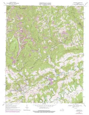
Honaker Topo Map Virginia
To zoom in, hover over the map of Honaker
USGS Topo Quad 37081a8 - 1:24,000 scale
| Topo Map Name: | Honaker |
| USGS Topo Quad ID: | 37081a8 |
| Print Size: | ca. 21 1/4" wide x 27" high |
| Southeast Coordinates: | 37° N latitude / 81.875° W longitude |
| Map Center Coordinates: | 37.0625° N latitude / 81.9375° W longitude |
| U.S. State: | VA |
| Filename: | o37081a8.jpg |
| Download Map JPG Image: | Honaker topo map 1:24,000 scale |
| Map Type: | Topographic |
| Topo Series: | 7.5´ |
| Map Scale: | 1:24,000 |
| Source of Map Images: | United States Geological Survey (USGS) |
| Alternate Map Versions: |
Honaker VA 1935 Download PDF Buy paper map Honaker VA 1968, updated 1972 Download PDF Buy paper map Honaker VA 1968, updated 1978 Download PDF Buy paper map Honaker VA 2010 Download PDF Buy paper map Honaker VA 2013 Download PDF Buy paper map Honaker VA 2016 Download PDF Buy paper map |
1:24,000 Topo Quads surrounding Honaker
> Back to 37081a1 at 1:100,000 scale
> Back to 37080a1 at 1:250,000 scale
> Back to U.S. Topo Maps home
Honaker topo map: Gazetteer
Honaker: Populated Places
Dye elevation 610m 2001′Flatrock elevation 618m 2027′
Garden elevation 716m 2349′
Gardner elevation 579m 1899′
Hickory Junction elevation 562m 1843′
Honaker elevation 570m 1870′
Laurel elevation 588m 1929′
Lynn Spring elevation 687m 2253′
Putnam elevation 571m 1873′
Russell elevation 692m 2270′
Swords Creek elevation 570m 1870′
Tarkiln elevation 644m 2112′
Honaker: Ridges
Big Lick Ridge elevation 772m 2532′Hollow Poplar Ridge elevation 794m 2604′
Middle Ridge elevation 765m 2509′
Road Ridge elevation 785m 2575′
Robinson Ridge elevation 769m 2522′
Honaker: Streams
Big Lick Creek elevation 637m 2089′Casey Branch elevation 559m 1833′
Duncan Branch elevation 575m 1886′
Elkins Branch elevation 648m 2125′
Flatrock Creek elevation 634m 2080′
Fuller Branch elevation 624m 2047′
Grassy Creek elevation 659m 2162′
Hatfield Creek elevation 717m 2352′
Hess Creek elevation 648m 2125′
Laurel Branch elevation 584m 1916′
Little River elevation 558m 1830′
Long Branch elevation 592m 1942′
Pine Creek elevation 680m 2230′
Right Fork Mill Creek elevation 678m 2224′
Robinson Run elevation 642m 2106′
Rock Lick Branch elevation 661m 2168′
Sample Branch elevation 562m 1843′
Steakman Branch elevation 712m 2335′
Steel Branch elevation 569m 1866′
Stone Branch elevation 583m 1912′
Strow Creek elevation 681m 2234′
Sulphur Spring Branch elevation 589m 1932′
Sword Creek elevation 569m 1866′
Waddy Branch elevation 568m 1863′
Honaker: Summits
Fuller Mountain elevation 848m 2782′Stone Mountain elevation 811m 2660′
Honaker: Valleys
Beehive Hollow elevation 674m 2211′Bob Hollow elevation 602m 1975′
Camp Hollow elevation 691m 2267′
Groundhog Hollow elevation 625m 2050′
Jeff Hollow elevation 705m 2312′
Lenn Hollow elevation 638m 2093′
Maple Hollow elevation 707m 2319′
Miller Hollow elevation 582m 1909′
Sandy Ridge Hollow elevation 738m 2421′
Stilwell Hollow elevation 611m 2004′
Wolfpen Hollow elevation 689m 2260′
Wysor Valley elevation 559m 1833′
Honaker digital topo map on disk
Buy this Honaker topo map showing relief, roads, GPS coordinates and other geographical features, as a high-resolution digital map file on DVD:
Western Virginia & Southern West Virginia
Buy digital topo maps: Western Virginia & Southern West Virginia


