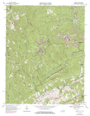
Amonate Topo Map Virginia
To zoom in, hover over the map of Amonate
USGS Topo Quad 37081b6 - 1:24,000 scale
| Topo Map Name: | Amonate |
| USGS Topo Quad ID: | 37081b6 |
| Print Size: | ca. 21 1/4" wide x 27" high |
| Southeast Coordinates: | 37.125° N latitude / 81.625° W longitude |
| Map Center Coordinates: | 37.1875° N latitude / 81.6875° W longitude |
| U.S. States: | VA, WV |
| Filename: | o37081b6.jpg |
| Download Map JPG Image: | Amonate topo map 1:24,000 scale |
| Map Type: | Topographic |
| Topo Series: | 7.5´ |
| Map Scale: | 1:24,000 |
| Source of Map Images: | United States Geological Survey (USGS) |
| Alternate Map Versions: |
Bandy VA 1934 Download PDF Buy paper map Amonate VA 1968, updated 1972 Download PDF Buy paper map Amonate VA 1968, updated 1978 Download PDF Buy paper map Amonate VA 2011 Download PDF Buy paper map Amonate VA 2013 Download PDF Buy paper map Amonate VA 2016 Download PDF Buy paper map |
1:24,000 Topo Quads surrounding Amonate
> Back to 37081a1 at 1:100,000 scale
> Back to 37080a1 at 1:250,000 scale
> Back to U.S. Topo Maps home
Amonate topo map: Gazetteer
Amonate: Basins
Sinking Waters elevation 703m 2306′Amonate: Dams
Dry Fork Slurry Impoundment Dam elevation 578m 1896′Amonate: Populated Places
Amonate elevation 529m 1735′Bandy elevation 660m 2165′
Bearwallow elevation 929m 3047′
Bevers Store (historical) elevation 555m 1820′
Camp Tazewell elevation 550m 1804′
Canebrake elevation 468m 1535′
Dunford Village elevation 527m 1729′
Faraday elevation 510m 1673′
Gap Store elevation 603m 1978′
Harman elevation 664m 2178′
Hix (historical) elevation 505m 1656′
Lamberts Store elevation 637m 2089′
Pleasant Hill elevation 728m 2388′
Vallscreek elevation 487m 1597′
Amonate: Post Offices
Vallscreek Post Office elevation 478m 1568′Amonate: Reservoirs
Vallscreek Slurry Pond elevation 578m 1896′Amonate: Ridges
Big Fork Ridge elevation 831m 2726′Kewee Ridge elevation 688m 2257′
Rocky Ridge elevation 782m 2565′
Stone Steps elevation 885m 2903′
Tennessee Valley Divide elevation 851m 2791′
Tennessee Valley Divide elevation 851m 2791′
Whetstone Ridge elevation 892m 2926′
Whitaker Ridge elevation 878m 2880′
Amonate: Streams
Beech Fork elevation 494m 1620′Beech Fork elevation 493m 1617′
Bills Branch elevation 543m 1781′
Coal Branch elevation 642m 2106′
Greasy Creek elevation 663m 2175′
Jackson Fork elevation 686m 2250′
Johny Branch elevation 586m 1922′
Lewis Fork elevation 548m 1797′
Lick Branch elevation 580m 1902′
Long Branch elevation 549m 1801′
North Branch Indian Creek elevation 715m 2345′
Panther Branch elevation 653m 2142′
Ray Fork elevation 558m 1830′
South Branch Indian Creek elevation 715m 2345′
Vall Creek elevation 479m 1571′
William Branch elevation 551m 1807′
Amonate: Summits
Stone Steps elevation 867m 2844′The Jumps elevation 655m 2148′
Amonate: Valleys
Thirtyone Hollow elevation 508m 1666′Amonate digital topo map on disk
Buy this Amonate topo map showing relief, roads, GPS coordinates and other geographical features, as a high-resolution digital map file on DVD:
Western Virginia & Southern West Virginia
Buy digital topo maps: Western Virginia & Southern West Virginia


