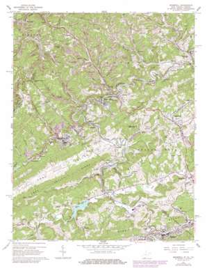
Bramwell Topo Map West Virginia
To zoom in, hover over the map of Bramwell
USGS Topo Quad 37081c3 - 1:24,000 scale
| Topo Map Name: | Bramwell |
| USGS Topo Quad ID: | 37081c3 |
| Print Size: | ca. 21 1/4" wide x 27" high |
| Southeast Coordinates: | 37.25° N latitude / 81.25° W longitude |
| Map Center Coordinates: | 37.3125° N latitude / 81.3125° W longitude |
| U.S. States: | WV, VA |
| Filename: | o37081c3.jpg |
| Download Map JPG Image: | Bramwell topo map 1:24,000 scale |
| Map Type: | Topographic |
| Topo Series: | 7.5´ |
| Map Scale: | 1:24,000 |
| Source of Map Images: | United States Geological Survey (USGS) |
| Alternate Map Versions: |
Bramwell WV 1962, updated 1964 Download PDF Buy paper map Bramwell WV 1962, updated 1979 Download PDF Buy paper map Bramwell WV 2001, updated 2003 Download PDF Buy paper map Bramwell WV 2011 Download PDF Buy paper map Bramwell WV 2014 Download PDF Buy paper map Bramwell WV 2016 Download PDF Buy paper map |
1:24,000 Topo Quads surrounding Bramwell
> Back to 37081a1 at 1:100,000 scale
> Back to 37080a1 at 1:250,000 scale
> Back to U.S. Topo Maps home
Bramwell topo map: Gazetteer
Bramwell: Dams
Falls Mills Dam elevation 708m 2322′New Bramwell Water Supply Dam elevation 758m 2486′
Old Bramwell Water Supply Dam elevation 758m 2486′
Pinnacle Rock Lake Dam elevation 719m 2358′
Bramwell: Gaps
Peeled Chestnut Gap elevation 858m 2814′Peeled Chestnut Gap elevation 855m 2805′
Bramwell: Mines
Pocahontas Mine elevation 723m 2372′Bramwell: Parks
Bramell Historic District elevation 686m 2250′Pinnacle Rock State Park elevation 746m 2447′
Pocahontas Historic District elevation 708m 2322′
Bramwell: Pillars
Pinnacle Rock elevation 843m 2765′Bramwell: Populated Places
Abbs Valley (historical) elevation 700m 2296′Bernietown elevation 735m 2411′
Big Vein elevation 731m 2398′
Bluefield elevation 722m 2368′
Bluestone elevation 711m 2332′
Bluewell elevation 791m 2595′
Bramwell elevation 686m 2250′
Brush Fork elevation 733m 2404′
Coaldale elevation 765m 2509′
Coopers elevation 693m 2273′
Duhring elevation 689m 2260′
Falls Mills elevation 710m 2329′
Flipping elevation 681m 2234′
Freeman elevation 685m 2247′
Godfrey elevation 697m 2286′
Goodwill elevation 695m 2280′
Hales Bottom elevation 713m 2339′
Hereford elevation 723m 2372′
Maybeury elevation 632m 2073′
Midway elevation 762m 2500′
Montcalm elevation 676m 2217′
Nemours elevation 714m 2342′
Pocahontas elevation 710m 2329′
Ruth (historical) elevation 733m 2404′
Shinbrier elevation 694m 2276′
Simmons elevation 708m 2322′
Wolfe elevation 702m 2303′
Yards elevation 726m 2381′
Yards elevation 726m 2381′
Bramwell: Post Offices
Bluefield Post Office elevation 725m 2378′Coaldale Post Office elevation 766m 2513′
Duhring Post Office elevation 686m 2250′
Montcalm Post Office elevation 675m 2214′
Nemours Post Office elevation 717m 2352′
Bramwell: Reservoirs
Bramwell Lake elevation 758m 2486′Falls Mills Lake elevation 708m 2322′
Pinnacle Rock Lake Number One elevation 719m 2358′
Bramwell: Ridges
Mount Sinai Ridge elevation 795m 2608′Bramwell: Streams
Beaverpond Creek elevation 734m 2408′Belcher Branch elevation 684m 2244′
Big Branch elevation 698m 2290′
Brush Fork elevation 705m 2312′
Coal Run elevation 714m 2342′
Crane Creek elevation 675m 2214′
Flipping Creek elevation 675m 2214′
Haynes Branch elevation 734m 2408′
Jims Branch elevation 676m 2217′
Jonathan Branch elevation 730m 2395′
Laurel Fork elevation 691m 2267′
Lick Branch elevation 696m 2283′
Little Fork elevation 628m 2060′
Little Fork elevation 677m 2221′
Lorton Lick Creek elevation 674m 2211′
Lower Georges Branch elevation 679m 2227′
Mill Creek elevation 689m 2260′
Mud Fork elevation 704m 2309′
Reeds Branch elevation 724m 2375′
Simmons Creek elevation 686m 2250′
Bramwell: Summits
Coaldale Mountain elevation 864m 2834′Pinnacle elevation 948m 3110′
Bramwell: Valleys
Abbs Valley elevation 718m 2355′Bablin Hollow elevation 694m 2276′
Barlow Hollow elevation 628m 2060′
Booths Hollow elevation 720m 2362′
Buckeye Hollow elevation 700m 2296′
Butt Hollow elevation 699m 2293′
Goodwill Hollow elevation 695m 2280′
Happy Hollow elevation 679m 2227′
Hicks Hollow elevation 678m 2224′
Hunk Hollow elevation 693m 2273′
Jones Dam Hollow elevation 710m 2329′
Neal Hollow elevation 721m 2365′
Neal Hollow elevation 714m 2342′
Perdue Hollow elevation 717m 2352′
Pratter Hollow elevation 707m 2319′
Pratter Hollow elevation 710m 2329′
Sawmill Hollow elevation 694m 2276′
Tuggle Hollow elevation 676m 2217′
West Fork Hollow elevation 707m 2319′
Bramwell digital topo map on disk
Buy this Bramwell topo map showing relief, roads, GPS coordinates and other geographical features, as a high-resolution digital map file on DVD:
Western Virginia & Southern West Virginia
Buy digital topo maps: Western Virginia & Southern West Virginia


