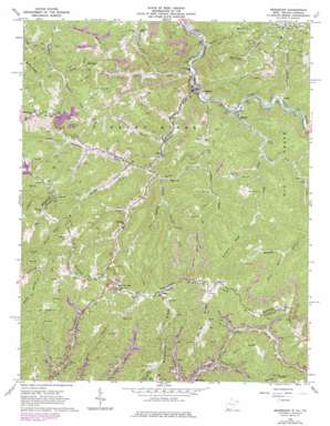
Bradshaw Topo Map West Virginia
To zoom in, hover over the map of Bradshaw
USGS Topo Quad 37081c7 - 1:24,000 scale
| Topo Map Name: | Bradshaw |
| USGS Topo Quad ID: | 37081c7 |
| Print Size: | ca. 21 1/4" wide x 27" high |
| Southeast Coordinates: | 37.25° N latitude / 81.75° W longitude |
| Map Center Coordinates: | 37.3125° N latitude / 81.8125° W longitude |
| U.S. States: | WV, VA |
| Filename: | o37081c7.jpg |
| Download Map JPG Image: | Bradshaw topo map 1:24,000 scale |
| Map Type: | Topographic |
| Topo Series: | 7.5´ |
| Map Scale: | 1:24,000 |
| Source of Map Images: | United States Geological Survey (USGS) |
| Alternate Map Versions: |
Bradshaw WV 1964, updated 1965 Download PDF Buy paper map Bradshaw WV 1964, updated 1975 Download PDF Buy paper map Bradshaw WV 1964, updated 1978 Download PDF Buy paper map Bradshaw WV 1996, updated 2003 Download PDF Buy paper map Bradshaw WV 2011 Download PDF Buy paper map Bradshaw WV 2014 Download PDF Buy paper map Bradshaw WV 2016 Download PDF Buy paper map |
1:24,000 Topo Quads surrounding Bradshaw
> Back to 37081a1 at 1:100,000 scale
> Back to 37080a1 at 1:250,000 scale
> Back to U.S. Topo Maps home
Bradshaw topo map: Gazetteer
Bradshaw: Gaps
Wimmer Gap elevation 699m 2293′Wimmer Gap elevation 697m 2286′
Bradshaw: Populated Places
Atwell elevation 378m 1240′Bradshaw elevation 358m 1174′
Dan elevation 366m 1200′
Height elevation 869m 2851′
Jolo elevation 418m 1371′
Lex elevation 346m 1135′
Peapatch elevation 875m 2870′
Peapatch elevation 867m 2844′
Raysal elevation 366m 1200′
Bradshaw: Post Offices
Raysal Post Office elevation 365m 1197′Bradshaw: Ridges
Brushytop Ridge elevation 780m 2559′Horse Ridge elevation 879m 2883′
Norton Ridge elevation 849m 2785′
Puckett Ridge elevation 762m 2500′
Redoak Ridge elevation 886m 2906′
Snake Ridge elevation 689m 2260′
Bradshaw: Streams
Aily Branch elevation 602m 1975′Aldrich Fork elevation 442m 1450′
Atwell Branch elevation 369m 1210′
Birchlick Branch elevation 453m 1486′
Bradshaw Creek elevation 356m 1167′
Breeden Branch elevation 590m 1935′
Coalbank Fork elevation 477m 1564′
Dry Branch elevation 361m 1184′
Dry Monday Branch elevation 414m 1358′
Groundhog Branch elevation 392m 1286′
Hite Fork elevation 407m 1335′
Hurricane Branch elevation 342m 1122′
Knob Branch elevation 629m 2063′
Laurel Fork elevation 499m 1637′
Left Fork Linn Camp Branch elevation 553m 1814′
Little Slate Creek elevation 361m 1184′
Middle Fork Bradshaw Creek elevation 416m 1364′
Oozley Branch elevation 354m 1161′
Right Fork Little Slate Creek elevation 404m 1325′
Turkey Branch elevation 454m 1489′
Vance Fork elevation 477m 1564′
Wolfpen Branch elevation 421m 1381′
Bradshaw: Summits
Compton Mountain elevation 801m 2627′Mullins Mountain elevation 778m 2552′
Bradshaw digital topo map on disk
Buy this Bradshaw topo map showing relief, roads, GPS coordinates and other geographical features, as a high-resolution digital map file on DVD:
Western Virginia & Southern West Virginia
Buy digital topo maps: Western Virginia & Southern West Virginia


