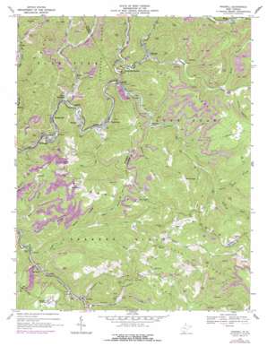
Rhodell Topo Map West Virginia
To zoom in, hover over the map of Rhodell
USGS Topo Quad 37081e3 - 1:24,000 scale
| Topo Map Name: | Rhodell |
| USGS Topo Quad ID: | 37081e3 |
| Print Size: | ca. 21 1/4" wide x 27" high |
| Southeast Coordinates: | 37.5° N latitude / 81.25° W longitude |
| Map Center Coordinates: | 37.5625° N latitude / 81.3125° W longitude |
| U.S. State: | WV |
| Filename: | o37081e3.jpg |
| Download Map JPG Image: | Rhodell topo map 1:24,000 scale |
| Map Type: | Topographic |
| Topo Series: | 7.5´ |
| Map Scale: | 1:24,000 |
| Source of Map Images: | United States Geological Survey (USGS) |
| Alternate Map Versions: |
Rhodell WV 1967, updated 1970 Download PDF Buy paper map Rhodell WV 1967, updated 1977 Download PDF Buy paper map Rhodell WV 1996, updated 2003 Download PDF Buy paper map Rhodell WV 2011 Download PDF Buy paper map Rhodell WV 2014 Download PDF Buy paper map Rhodell WV 2016 Download PDF Buy paper map |
1:24,000 Topo Quads surrounding Rhodell
> Back to 37081e1 at 1:100,000 scale
> Back to 37080a1 at 1:250,000 scale
> Back to U.S. Topo Maps home
Rhodell topo map: Gazetteer
Rhodell: Airports
Perry and Hylton Field elevation 673m 2208′Rhodell: Dams
Wyco Dam elevation 649m 2129′Rhodell: Gaps
Brushy Gap elevation 840m 2755′Sand Gap elevation 712m 2335′
Rhodell: Populated Places
Allen Junction elevation 451m 1479′Amigo elevation 479m 1571′
Basin elevation 734m 2408′
Beechwood elevation 448m 1469′
Blackeagle elevation 440m 1443′
Corinne elevation 444m 1456′
Herndon elevation 585m 1919′
Herndon Heights elevation 779m 2555′
Iroquois elevation 459m 1505′
Madeline elevation 539m 1768′
Mead elevation 537m 1761′
Montecarlo elevation 548m 1797′
Rhodell elevation 498m 1633′
Stephenson elevation 467m 1532′
Stonecoal Junction elevation 492m 1614′
Wyco elevation 471m 1545′
Rhodell: Post Offices
Basin Post Office elevation 719m 2358′Stephenson Post Office elevation 466m 1528′
Wyco Post Office elevation 478m 1568′
Rhodell: Ridges
Barkers Ridge elevation 823m 2700′Ivy Ridge elevation 709m 2326′
Milam Ridge elevation 861m 2824′
Peak Ridge elevation 900m 2952′
Tommy Ridge elevation 828m 2716′
Rhodell: Springs
London Mills Spring elevation 746m 2447′Rhodell: Streams
Allen Creek elevation 453m 1486′Beetree Branch elevation 516m 1692′
Big Branch elevation 463m 1519′
Bluff Fork elevation 622m 2040′
Bragg Branch elevation 547m 1794′
Comer Branch elevation 591m 1938′
Devils Fork elevation 475m 1558′
Gooney Otter Creek elevation 503m 1650′
Hickory Branch elevation 536m 1758′
Jims Branch elevation 575m 1886′
Lambert Branch elevation 480m 1574′
Left Fork Allen Creek elevation 494m 1620′
Lefthand Fork Tommy Creek elevation 584m 1916′
Middle Branch Barkers Creek elevation 543m 1781′
Milam Fork elevation 609m 1998′
Noseman Branch elevation 576m 1889′
Right Fork Cedar Creek elevation 468m 1535′
Stonecoal Creek elevation 489m 1604′
Tommy Creek elevation 480m 1574′
Turkey Branch elevation 569m 1866′
Wiley Spring Branch elevation 622m 2040′
Winding Gulf elevation 475m 1558′
Rhodell digital topo map on disk
Buy this Rhodell topo map showing relief, roads, GPS coordinates and other geographical features, as a high-resolution digital map file on DVD:
Western Virginia & Southern West Virginia
Buy digital topo maps: Western Virginia & Southern West Virginia


