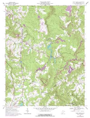
Shady Spring Topo Map West Virginia
To zoom in, hover over the map of Shady Spring
USGS Topo Quad 37081f1 - 1:24,000 scale
| Topo Map Name: | Shady Spring |
| USGS Topo Quad ID: | 37081f1 |
| Print Size: | ca. 21 1/4" wide x 27" high |
| Southeast Coordinates: | 37.625° N latitude / 81° W longitude |
| Map Center Coordinates: | 37.6875° N latitude / 81.0625° W longitude |
| U.S. State: | WV |
| Filename: | o37081f1.jpg |
| Download Map JPG Image: | Shady Spring topo map 1:24,000 scale |
| Map Type: | Topographic |
| Topo Series: | 7.5´ |
| Map Scale: | 1:24,000 |
| Source of Map Images: | United States Geological Survey (USGS) |
| Alternate Map Versions: |
Shady Spring WV 1968, updated 1971 Download PDF Buy paper map Shady Spring WV 1968, updated 1977 Download PDF Buy paper map Shady Spring WV 2011 Download PDF Buy paper map Shady Spring WV 2014 Download PDF Buy paper map Shady Spring WV 2016 Download PDF Buy paper map |
1:24,000 Topo Quads surrounding Shady Spring
> Back to 37081e1 at 1:100,000 scale
> Back to 37080a1 at 1:250,000 scale
> Back to U.S. Topo Maps home
Shady Spring topo map: Gazetteer
Shady Spring: Airports
Glade Springs Heliport elevation 774m 2539′Shady Spring: Dams
Beckley Water Supply Dam Number Two elevation 866m 2841′Flat Top Lake Dam elevation 885m 2903′
Glade Creek Reservoir Dam elevation 808m 2650′
Shady Spring: Parks
Little Beaver State Park elevation 763m 2503′Shady Spring: Populated Places
Blue Jay 6 elevation 828m 2716′Cherry Creek elevation 858m 2814′
Cool Ridge elevation 895m 2936′
Daniels elevation 724m 2375′
Glade Springs elevation 851m 2791′
Mountview elevation 908m 2979′
Shady Spring elevation 822m 2696′
Streeter elevation 604m 1981′
White Oak elevation 865m 2837′
Shady Spring: Post Offices
Cool Ridge Post Office elevation 895m 2936′Daniels Post Office elevation 722m 2368′
Shady Spring Post Office elevation 822m 2696′
White Oak Post Office elevation 838m 2749′
Shady Spring: Reservoirs
Beckly Water Supply Number One Lake elevation 808m 2650′Flat Top Lake elevation 885m 2903′
Flat Top Lake elevation 886m 2906′
Glade Creek Reservoir elevation 811m 2660′
Shady Spring: Ridges
Joes Ridge elevation 1000m 3280′Shady Spring: Springs
Flowing Well Spring elevation 800m 2624′Shady Spring: Streams
Basham Branch elevation 650m 2132′Cherry Creek elevation 777m 2549′
Cooper Creek elevation 820m 2690′
Farley Creek elevation 872m 2860′
Lefthand Fork Cooper Creek elevation 820m 2690′
Little Beaver Creek elevation 692m 2270′
Little Beaver Creek elevation 741m 2431′
Oak Creek elevation 874m 2867′
Sal Willis Branch elevation 696m 2283′
Sims Branch elevation 747m 2450′
Spicelick Creek elevation 632m 2073′
Squealing Fork elevation 738m 2421′
Shady Spring: Summits
Shady Spring Mountain elevation 894m 2933′Shady Spring digital topo map on disk
Buy this Shady Spring topo map showing relief, roads, GPS coordinates and other geographical features, as a high-resolution digital map file on DVD:
Western Virginia & Southern West Virginia
Buy digital topo maps: Western Virginia & Southern West Virginia


